
|
|
| ÖSTERREICH | AUSTRIA |
| Bundesland: Niederösterreich | Lower Austria |
| Bezirk: Zwettl |
map →

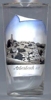
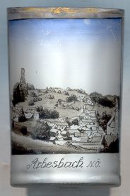
 The market town Arbesbach is situated at an elevation of 849 m at the upper course
of the river Großer Kamp in the Waldviertel region of Lower Austria.
The first mention in a document (Arwaizpach) dates back to 1246.
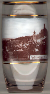
The market town Arbesbach is situated at an elevation of 849 m at the upper course
of the river Großer Kamp in the Waldviertel region of Lower Austria.
The first mention in a document (Arwaizpach) dates back to 1246.
The  parish church Sankt ägidius [left, no. 1024: bottom right; right, no. 006: right]
was built 1761–1772 in Baroque style. The parish was established in 1245.
parish church Sankt ägidius [left, no. 1024: bottom right; right, no. 006: right]
was built 1761–1772 in Baroque style. The parish was established in 1245.
The ruins of the castle [left, no. 1024: left; right, no. 006: top right]
are the remnants of a construction of the 12th century.
The castle keep is nicknamed 'the molar tooth of the Waldviertel'.
![[scale]](lineal.jpg)