
|
|
| DEUTSCHLAND | GERMANY |
| Bundesland: Rheinland-Pfalz | Rhineland-Palatinate |
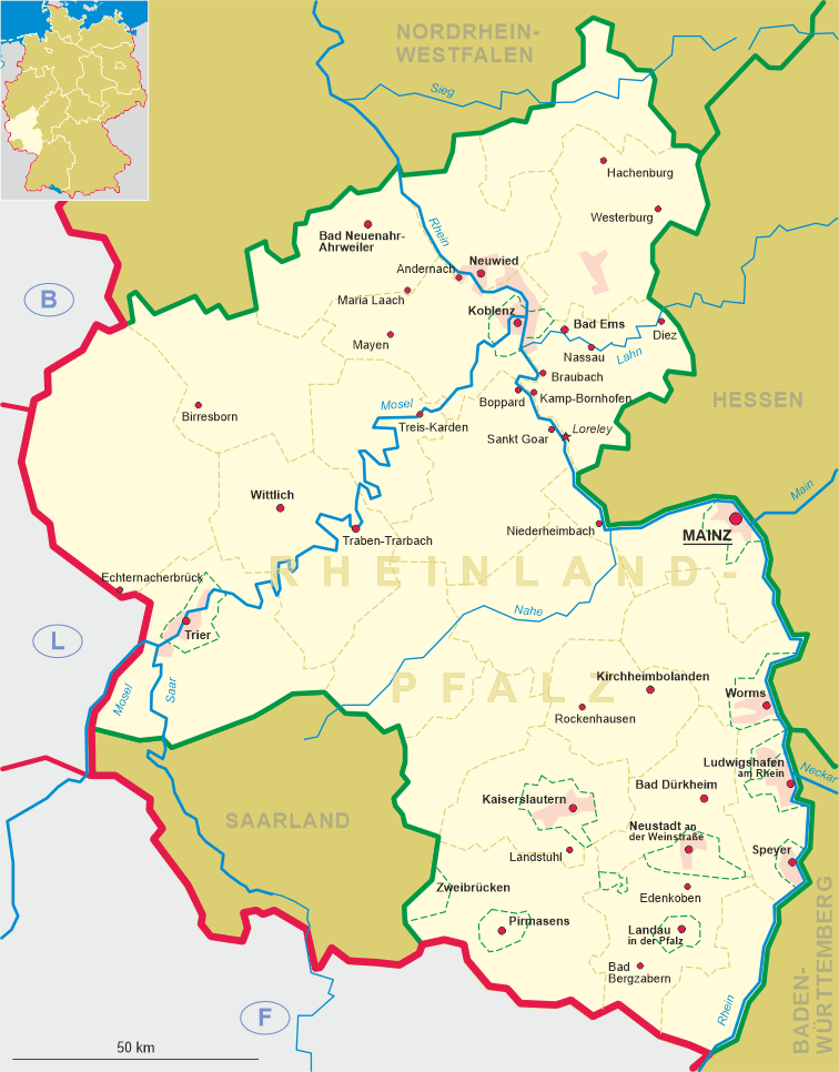
| Landkreis: Mayen-Koblenz |
map →
Andernach is situated at an elevation of 59 m on the left bank of the river Rhine. The oldest traces of human settlements in the area of the town
date from the 4th century BC When the Romans began their wars agains the Germanic tribes on the right bank of the river in 12 BC,
the settlement Antunnacum and its river harbour were enlarged. Antunnacum became an important centre for trading during the 2nd and 3rd century AD.
When the Frankish King Childebert II travelled by ship from Metz to Andernach in AD 588, his companion Venantius Fortunatus described Andernach in a poem.
The defeat of Karl II ('the Bald'), king of the West Franks, by Ludwig III, king of the East-Frankish kingdom, in the battle of Andernach (AD 876) secured the rhineland as part of the eastern kingdom.
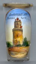
The  Round Tower (Runder Turm) [left] is the landmark of Andernach. It was built in 1440–1453
and is one of Germany's most impressive medieval towers (56 m high). During the Palatinate War of Succession in 1689, the French army destroyed most of the town and also
tried to blow up the tower, but its walls (4 m thick) easily withstood the attempts.
Round Tower (Runder Turm) [left] is the landmark of Andernach. It was built in 1440–1453
and is one of Germany's most impressive medieval towers (56 m high). During the Palatinate War of Succession in 1689, the French army destroyed most of the town and also
tried to blow up the tower, but its walls (4 m thick) easily withstood the attempts.
A natural sight is the 'Geysir Andernach' (formerly 'Nameder Sprudel'), the highest(50–60 m) cold-water geyser
in Europe. Created by drilling a borehole to a depth of 343 metres in 1903, it was firt used for obtaining mineral
water and as a tourist attraction. The installation deteriorated over time so that it was closed in 1957. A second borehole
was drilled in 2001; since 2006, following a lengthy legal dispute between the city of Andernach and the German Federation
for the Environment and Nature Conservation, the geyser is again one of the natural attarctions of Andernach. Eruptions last
for about 8 minutes and occur at intervals of about 2 hours. Outside the opening times, the borehole is closed off
for security reasons.
The only other cold-water geyser in Europe (outside Iceland) is located in Herľany,
Slovakia.
[https://de.wikipedia.org/wiki/Geysir_Andernach]
![[scale]](lineal.jpg)