
|
|
| ÖSTERREICH | AUSTRIA |
| Bundesland: Niederösterreich | Lower Austria |
| Bezirk: Lilienfeld |
map →

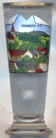
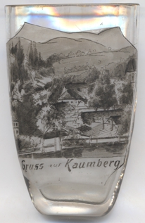
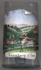 Kaumberg is situated at an elevation of 494 m in the upper Traisen valley of southern Lower Austria.
Kaumberg was chartered as a market town in 1580.
Kaumberg is situated at an elevation of 494 m in the upper Traisen valley of southern Lower Austria.
Kaumberg was chartered as a market town in 1580.
The Gothic  parish church Heiliger Erzengel Michael [top left]
is located on a hill above the town. The choir dates from around 1400, the tower was completed in 1502.
parish church Heiliger Erzengel Michael [top left]
is located on a hill above the town. The choir dates from around 1400, the tower was completed in 1502.
The Araburg castle [background top, barely visible]
was built around 1180 and was first mentioned in 1190/1209. Since 1625 it was in possession of the monastery of
Lilienfeld. The castle was destroyed in 1683 by Turkish invaders. Parts of the ruins
were restored during the 20th century.
![[scale]](lineal.jpg)