
|
|
| DEUTSCHLAND | GERMANY |
| Bundesland: Schleswig-Holstein | |
| Kreis: Schleswig-Flensburg |
map →
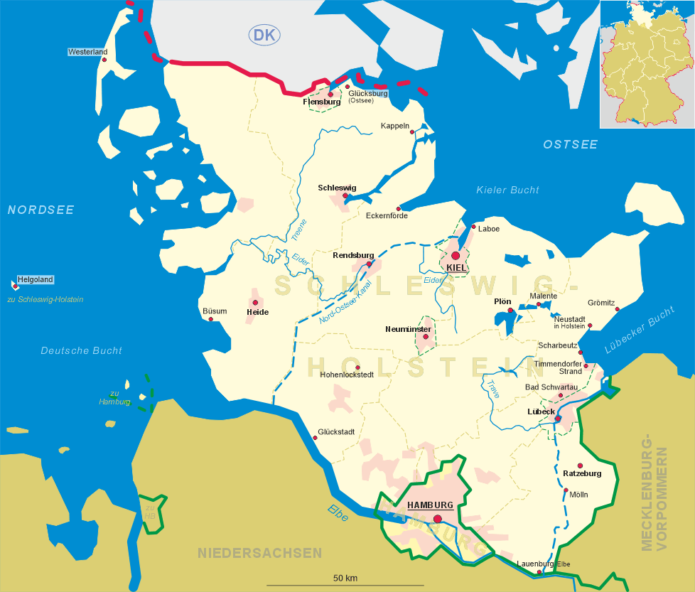
 Kappeln (Danish: Kappel) is situated at an elevation of 10 m on the river Schlei near the eastern coast of
Schleswig-Holstein. The municipality has a population of about 8,600 (2018) and also comprises the localities Mehlby
(in Danish: Melby), Dothmark (Dotmark), Sandbek (Sandbæk), Stutebüll (Studebøl), Ellenberg (Ellebjerg),
Olpenitz (Olpenæs) and Kopperby (Kobberby).
Kappeln (Danish: Kappel) is situated at an elevation of 10 m on the river Schlei near the eastern coast of
Schleswig-Holstein. The municipality has a population of about 8,600 (2018) and also comprises the localities Mehlby
(in Danish: Melby), Dothmark (Dotmark), Sandbek (Sandbæk), Stutebüll (Studebøl), Ellenberg (Ellebjerg),
Olpenitz (Olpenæs) and Kopperby (Kobberby).
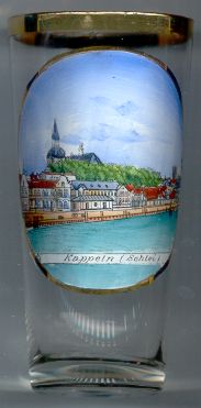
The place began to develop as a fishermen's village with a chapel, which also became the origin of the village's name (Kapelle = chapel). The oldest document mentioning "dat Dorp tho Cappel" dates from 1357. Between 1406 and 1533 it belonged to the cathedral chapter of Schleswig. In 1797 the royal Danish governor of Schleswig-Holstein, landgrave Karl of Hesse-Kassel, purchased Kappeln where he abolished serfom in 1799. In 1846 Kappeln became a 'Flecken', i.e. a market town. In 1870 it was finally chartered as a town and its name, until then Cappeln, was officially changed to Kappeln. In the 1930s Kappeln became a military post. The naval base of Olpenitz was founded in 1959 (but was closed in 2004/2006). In 1974 the neighbouring municipalities of Kopperby and Mehlby were merged into the municipality of Kappeln.
The  Nikolaikirche (church of St. Nicholas) [background left]
was built in 1789–1793 in late Baroque style in place of a previous chapel.
Nikolaikirche (church of St. Nicholas) [background left]
was built in 1789–1793 in late Baroque style in place of a previous chapel.
[https://de.wikipedia.org/wiki/Kappeln;
https://www.kappeln.de/custom/1760_130_1.PDF, https://www.kappeln.de/Unsere-Stadt/Stadtarchiv/Geschichte;
https://de.wikipedia.org/wiki/Karl_von_Hessen-Kassel;
https://de.wikipedia.org/wiki/St._Nikolai_(Kappeln)]
![[scale]](lineal.jpg)