
|
|
| MAGYARORSZÁG | HUNGARY |
| megye: Vas |
map →
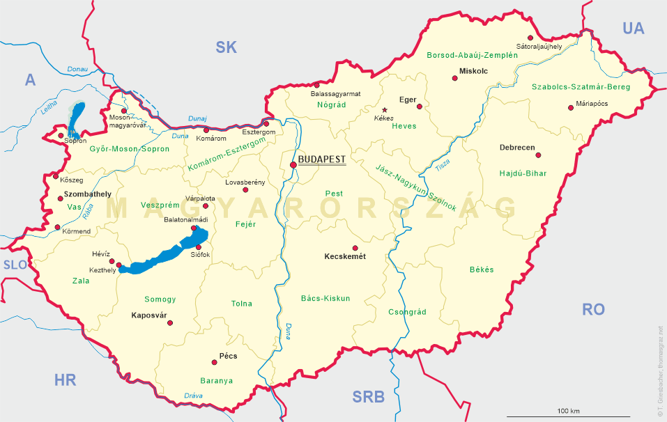
 Kőszeg is situated at an elevation of 284 m in western Hungary at the border to Austria.
Kuszug was first mentioned in 1248. The fortified town began to develop in the valley of the Gyöngyös
(Günsbach) stream and took its name from the ancient castle Kőszeg above the town. The German name,
Güns, also dates from that early period. Between 1445 and 1847 Kőszeg was administered by Lower Austria.
The most famous event in the history of the town was the siege by a Turkish army in 1532. 800 men defended Kőszeg
successfully against 60,000 Turkish soldiers and also prevented the advancement of the Turks towards
Vienna. In 1648 Kőszeg obtained the status of a Royal Free City. From 1695 until 1931
Kőszeg was a residence of the princes Esterházy. Since 1920, when the German-speaking parts of western
Hungary became part of Austria (province Burgenland), Kőszeg is a border town.
Kőszeg is situated at an elevation of 284 m in western Hungary at the border to Austria.
Kuszug was first mentioned in 1248. The fortified town began to develop in the valley of the Gyöngyös
(Günsbach) stream and took its name from the ancient castle Kőszeg above the town. The German name,
Güns, also dates from that early period. Between 1445 and 1847 Kőszeg was administered by Lower Austria.
The most famous event in the history of the town was the siege by a Turkish army in 1532. 800 men defended Kőszeg
successfully against 60,000 Turkish soldiers and also prevented the advancement of the Turks towards
Vienna. In 1648 Kőszeg obtained the status of a Royal Free City. From 1695 until 1931
Kőszeg was a residence of the princes Esterházy. Since 1920, when the German-speaking parts of western
Hungary became part of Austria (province Burgenland), Kőszeg is a border town.
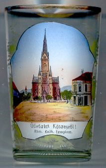
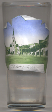
The pictures on the glasses no. 1516 [left] and no. 3888 [right] show the
 Sacred
[http://www.koszeginfo.com/en/about-koszeg/history-of-koszeg,
https://de.wikipedia.org/wiki/Kőszeg, https://hu.wikipedia.org/wiki/K%C5%91szeg;
https://en.wikipedia.org/wiki/Sacred_Heart_Church_(Kőszeg,_Hungary)]
![[scale]](lineal.jpg)