
|
|
| DEUTSCHLAND | GERMANY |
| Bundesland: Freistaat Bayern | Bavaria |
| Regierungsbezirk: Oberbayern | |
| Landkreis: Erding |
map →

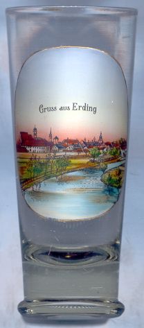 The district town Erding is situated at an elevation of 463 m northeast of Munich in Upper Bavaria.
Ardeingas (Altenerding) was first mentioned in a document of AD 788. The town of Erding itself was founded in 1228 by
Duke Ludwig I of Bavaria (called the "Kelheimer"). After the first partition of the countries of
the Wittelsbach dynasty in 1255, Erding became part of Lower Bavaria (Bayern-Landshut). During the Bavarian War of Succession
Erding was conquered in 1503 by Duke Albrecht IV of Upper Bavaria (Bayern-München), which was followed
by the unification of the two duchies in 1505/06. During the Thirty Years' War the city was looted and burnt in 1632, 1634, and finally in 1648.
After the creation in 1806 of the Kingdom of Bavaria, Erding became part of the newly-created Isar region (today administrative
region Upper Bavaria). Altenerding and Langengeisling were merged with the city of Erding in 1978.
The district town Erding is situated at an elevation of 463 m northeast of Munich in Upper Bavaria.
Ardeingas (Altenerding) was first mentioned in a document of AD 788. The town of Erding itself was founded in 1228 by
Duke Ludwig I of Bavaria (called the "Kelheimer"). After the first partition of the countries of
the Wittelsbach dynasty in 1255, Erding became part of Lower Bavaria (Bayern-Landshut). During the Bavarian War of Succession
Erding was conquered in 1503 by Duke Albrecht IV of Upper Bavaria (Bayern-München), which was followed
by the unification of the two duchies in 1505/06. During the Thirty Years' War the city was looted and burnt in 1632, 1634, and finally in 1648.
After the creation in 1806 of the Kingdom of Bavaria, Erding became part of the newly-created Isar region (today administrative
region Upper Bavaria). Altenerding and Langengeisling were merged with the city of Erding in 1978.
![[scale]](lineal.jpg)