
|
|
| POLSKA | POLAND |
| województwo: Lubuskie | voivodship: Lebus |
| powiat: Żary | county: Żary |
map →
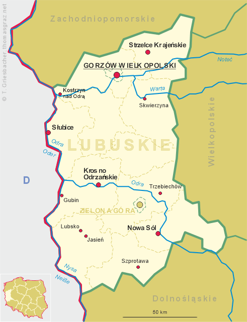
 Jasień (German: Gassen) is situated at an elevation of 291 m on the river Lubsza (Lubst) about 15 km northeast of the
district town Żary (Sorau) in western Poland.
The municipality of Jasień consists of the city of Jasień and the villages of Bronice, Bieszków, Budzechów, Golin, Guzów, Jabłoniec,
Jaryszów, Jasionna, Jurzyn, Lisia Góra, Lips Żarski, Mirkowice, Rostoki, Świbna, Wicina, Zabłocie and Zieleniec.
Jasień (German: Gassen) is situated at an elevation of 291 m on the river Lubsza (Lubst) about 15 km northeast of the
district town Żary (Sorau) in western Poland.
The municipality of Jasień consists of the city of Jasień and the villages of Bronice, Bieszków, Budzechów, Golin, Guzów, Jabłoniec,
Jaryszów, Jasionna, Jurzyn, Lisia Góra, Lips Żarski, Mirkowice, Rostoki, Świbna, Wicina, Zabłocie and Zieleniec.
The odlest documents mentioning the place date from 1320. In the mid-7th century it obtained the privileges of a town. From then on it developed into a centre of textile and ceramic manufactures, in the 19th century also of machine industry. During World War II Gassen was the site of a branch camp of the concentration camp of Groß-Rosen (Rogoźnica). After World War II, the town was named Gocław in 1945, but in 1946 was renamed Jasień.
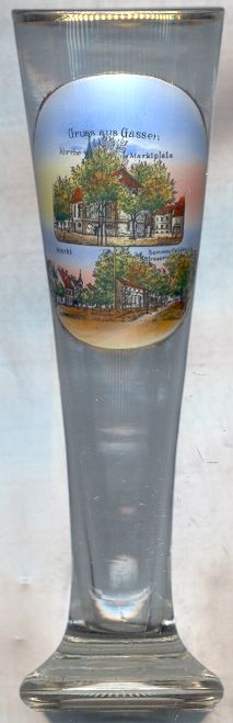
The  parish church [top] of Jasień was founded in the second half of the 17th century. The original wooden church
was replaced by a new, Baroque church in 1733, the tower was finished in 1770. The upper part of the tower collapsed in 1872 during a strong storm
but was rebuilt within one year.
parish church [top] of Jasień was founded in the second half of the 17th century. The original wooden church
was replaced by a new, Baroque church in 1733, the tower was finished in 1770. The upper part of the tower collapsed in 1872 during a strong storm
but was rebuilt within one year.
![[scale]](lineal.jpg)