
|
|
| POLSKA | POLAND |
| województwo: Śląskie | voivodship: Silesia |
| powiat: Gliwice | county: Gliwice |
map →
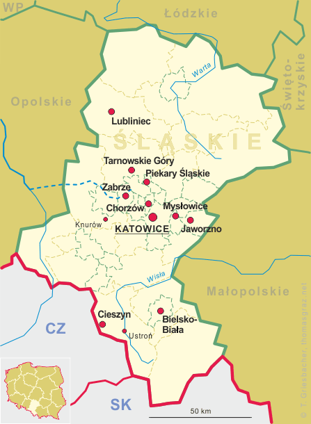
 Knurów is situated at an elevation of 243 m in the Gliwice county of the Silesian voivodship in southern Poland, about 7 km south of Gliwice
and 20 km west of Katowice. Knurów has a population of about 39,200 (2010).
Knurów is situated at an elevation of 243 m in the Gliwice county of the Silesian voivodship in southern Poland, about 7 km south of Gliwice
and 20 km west of Katowice. Knurów has a population of about 39,200 (2010).
Knurów was first mentioned in a document of 1305. In 1339 it came in possession of Bohemia, in 1479 of Hungary, and in 1490 of the Jagiellon dynasty before it became part of the Habsburg countries in 1526. In 1742 Silesia was conquered by Prussia. Knurów remained part of Prussia (in 1871 part of the German Empire) until the end of World war I. In 1919/1921 it became part of Poland. Between 1939 and 1945 it was occupied by Nazi Germany. In 1951 Knurów obtained the status of a city.
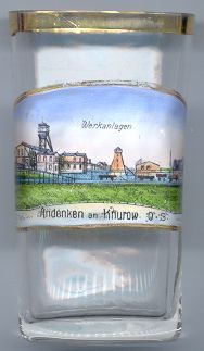
Mining activities atrted at the end of the 19th century. The first stone coal mine was founded in 1906.
The picture on glass no. 1924 show the  coal
coal
![[scale]](lineal.jpg)