
|
|
| DEUTSCHLAND | GERMANY |
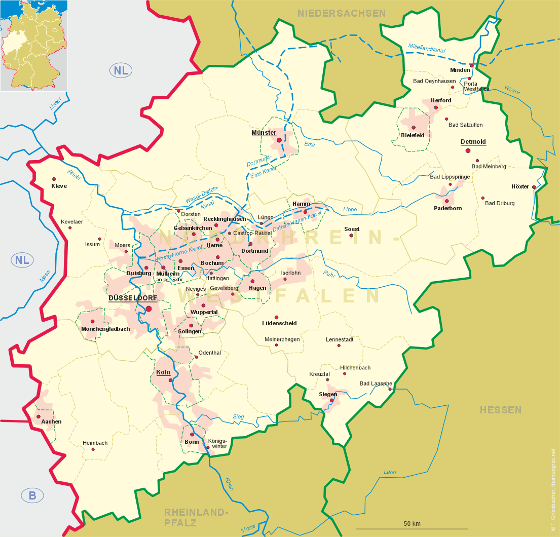
| Bundesland: Nordrhein-Westfalen | North Rhine-Westphalia |
| Regierungsbezirk: Detmold | |
| Kreis: Paderborn |
map →
 Paderborn is situated at an elevation of 158 m at the southeastern end of the Westfalian lowland
near the sources of the river Pader. Paderborn has a population of about 147,700 (2011).
Paderborn is situated at an elevation of 158 m at the southeastern end of the Westfalian lowland
near the sources of the river Pader. Paderborn has a population of about 147,700 (2011).
Already in 777 AD Paderborn was the location of a diet under Emperor Charlemagne. In 799 it was the site of a meeting of Charlemagne with Pope Leo III who founded the bishopric of Paderborn. In 836 the relics of St. Liborius were transfered from Le Mans to Paderborn. During the Middle Ages the bishops became the sovereign rulers of their country. The university was founded in 1614. After the secularisation of 1802 Paderborn became part of Prussia. During the Napoleonic times it belonged to the Kingdom of Westphalia between 1807 and 1813. After the Congress of Vienna in 1815 the town was returned to Prussia in 1816 and became the administrative seat of the district Paderborn. The university on the other hand was dissolved by the Prussian administration. During the second half of the 19th century Paderborn was connected to the railroad system. The line to Hamm was opened in 1850, the railroad to Kassel was completed in 1853, followed by the lines to Büren (1898), Bielefeld (1903) and Lippspringe (1906). The diocese of Paderborn was re-established in 1821 and elevated to an archdiocese in 1930. During World War II about 80% of the historic town were destroyed by Allied bomb raids in January and March of 1945. The new university of Paderborn was founded in 1972. On 1 January 1975 the neighbouring communities of Benhausen, Dahl, Elsen (Paderborn), Neuenbeken, Sande and Schloss Neuhaus were incorporated into the city of Paderborn. At the same time the former district of Büren was incorporated into the district Paderborn.
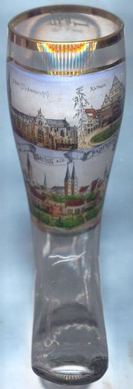
The  cathedral of Sankt Liborius [top left] is the popular landmark of Paderborn.
The history of the church goes back to the translation in 836 of the relics of its patron saint to this place.
Most parts of the present church date from the 13th century while mighty west tower (93 m high) already had been
built during the 12th century. The crypt, one of the largest (32 m long) in Germany, houses the relics of St. Liborius.
After the Thirty Years' War the interior of the church was redocorated in Baroque style. After severe damages in 1945
the church was rebuilt after the war. Treasures of the church are, among others, the Paradise Gate of prior to 1240,
the Pietà of around 1380, the Gothic high altar of the late 15th century, and a double madonna of around 1480.
cathedral of Sankt Liborius [top left] is the popular landmark of Paderborn.
The history of the church goes back to the translation in 836 of the relics of its patron saint to this place.
Most parts of the present church date from the 13th century while mighty west tower (93 m high) already had been
built during the 12th century. The crypt, one of the largest (32 m long) in Germany, houses the relics of St. Liborius.
After the Thirty Years' War the interior of the church was redocorated in Baroque style. After severe damages in 1945
the church was rebuilt after the war. Treasures of the church are, among others, the Paradise Gate of prior to 1240,
the Pietà of around 1380, the Gothic high altar of the late 15th century, and a double madonna of around 1480.
The Town Hall [top right] was built between 1613 and 1620 in the
typical Renaissance style of the Weser region.
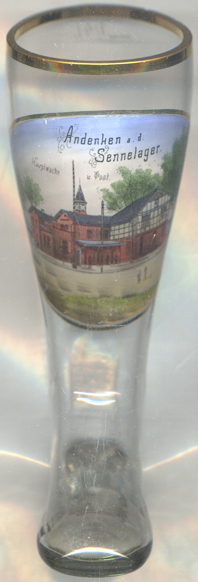 Sennelager is frequently thought to be a city district of Paderborn, but in fact is only a part of the
city district Schloß Neuhaus / Sande.
Sennelager is frequently thought to be a city district of Paderborn, but in fact is only a part of the
city district Schloß Neuhaus / Sande.
Sennelager was founded in 1851 as military camp (German 'Lager') for the Prussian cavalry. It was located in the Senne, which in those times was practically deserted and ideally suited for a military training area. After 1891, the camp was enlarged several times. During World War II, the camp was also used as a camp for prisoners of war (1941), and in 1944 an satellite camp of the concentration camp of Buchenwald for 30–34 prisoners was established. After 1945 the camp was at first used by the British administration as a detention centre. Today, it is still in use by British and NATO forces.
 The picture on glass no. 3080 [near left] shows a view of the
Hauptwache
The picture on glass no. 3080 [near left] shows a view of the
Hauptwache
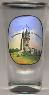
As the area of the military training area was mostly flat and lacked any landmarks for orientation, a great number of
artificial orientation points, such as farms, windmills, a chapel with cemetery, towers etc. were constructed. These
constructions of course only served as landmarks, but never were used as what they appeared to be.
Glass no. 3829 [right] shows one of these artificial landmarks, the
Diebesturm
[http://54146.dynamicboard.de/t1531f38-Windmuehle-als-militaerische-Zielscheibe.html]
Glasses of this collection showing former training areas of the German Empire:
Altengrabow (D),
Arys (Orszysz, PL),
Döberitz (D),
Hagenau (Haguenau, F),
Hammelburg (D),
Hammerstein (Czarne, PL),
Heuberg (Stetten am kalten Markt, D),
Lockstedter Lager (Hohenlockstedt, D),
Münsingen (D),
Munsterlager (Munster, D),
Sennelager (Paderborn, D).
Thorn (Toruń, PL).
Warthelager (Biedrusko, PL).
[https://de.wikipedia.org/wiki/Truppenübungsplätze_(Deutsches_Reich)]
![[scale]](lineal.jpg)