
|
|
| DEUTSCHLAND | GERMANY |
| Bundesland: Nordrhein-Westfalen | North Rhine-Westphalia |
| Regierungsbezirk: Arnsberg | |
| Kreis: Siegen-Wittgenstein |
map →
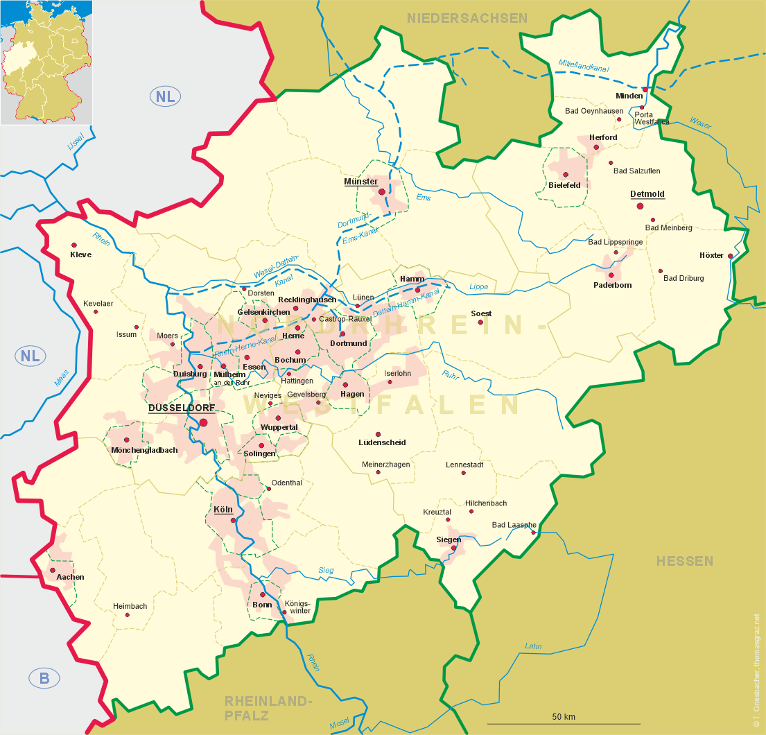
 Bad Laasphe is situated at an elevation of 333 m in the upper Lahn valley in the district
Siegen-Wittgenstein in the south of Germany's state of North Rhine-Westphalia.
Bad Laasphe is situated at an elevation of 333 m in the upper Lahn valley in the district
Siegen-Wittgenstein in the south of Germany's state of North Rhine-Westphalia.
The oldest written mention of villa lassafa is found in a document of around 800 AD, which probably refers to Laasphe. The earliest document that undoubtedly refers to this place dates from 1219. During the 13th century Laasphe must have obtained the status of a town. The exact date is not known, but it was repeatedly mentioned as the place of a law-court already in 1230 and 1240. A document of 1277 refers to it as 'civitas', i.e. a town. When the county of Wittgenstein became independent in 1238 the town began to flourish. The oldest building preserved in the town is the parish church, which had already been mentioned in 1230. The counts of Wittgenstein soon expanded their territory and defended their sovereignty against their neighbours, the landgraves of Hesse and the archbishops of Cologne. During these times, the town was pawned several times, but also obtained important privileges.
In 1359 the last count of Wittgenstein died without male heir. The territory was inherited by his son in law, count of Sayn who consequently founded the house of Sayn-Wittgenstein. In 1605 the county was divided into the counties Sayn-Wittgenstein-Berleburg (princes since 1792) and Sayn-Wittgenstein-Hohenstein (princes since 1801). Both Berleburg and Hohenstein (with Laasphe) lost their sovereignty after the Treaty of the Confederation of the Rhine in 1806 and became parts of the Grand Duchy of Hesse-Darmstadt. After the Congress of Vienna, the territory became part of the Prussian province Westfalia (1816 as district Berleburg, and 1817 as district Wittgenstein). In 1974 the district Wittgenstein was incorporated into the district Siegen; the district name Siegen-Wittgenstein became official in 1984. In 1975 the 21 neighbouring communities of Amtshausen, Banfe, Bermershausen, Bernshausen, Feudingen, Fischelbach, Großenbach, Heiligenborn, Herbertshausen, Hesselbach, Holzhausen, Kunst-Wittgenstein, Niederlaasphe, 0berndorf, Puderbach, Rückershausen, Rüppershausen, Saßmannshausen, Steinbach, Volkholz and Weide were incorporated into Laasphe.
Laasphe became a Kneipp spa in 1960. In 1984 the predicate 'Bad' (spa) was added to the name of the town.
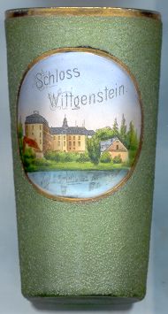
 Wittgenstein castle [left] is located on a hill (470 m) above Bad Laasphe.
The castle was first mentioned in 1187. the foundation of the castle marks the beginning of the county of Wittgenstein.
The northern wing of the castle mostly dates from the 16th century. In its western parts, the foundation of a
keep of the 12th century were discovered. The western and eastern wings of the castle originally were separate
building, but were connected to the central, northern, wing in the 18th century. The castle remained
the residence of the Counts (since 1801 Princes) of Sayn-Wittgenstein-Hohenstein until 1950 when the family moved to
Schwarzenau castle. Since 1954 the castle is home of a private boarding school (Institut Schloss Wittgenstein).
Wittgenstein castle [left] is located on a hill (470 m) above Bad Laasphe.
The castle was first mentioned in 1187. the foundation of the castle marks the beginning of the county of Wittgenstein.
The northern wing of the castle mostly dates from the 16th century. In its western parts, the foundation of a
keep of the 12th century were discovered. The western and eastern wings of the castle originally were separate
building, but were connected to the central, northern, wing in the 18th century. The castle remained
the residence of the Counts (since 1801 Princes) of Sayn-Wittgenstein-Hohenstein until 1950 when the family moved to
Schwarzenau castle. Since 1954 the castle is home of a private boarding school (Institut Schloss Wittgenstein).
![[scale]](lineal.jpg)