
|
|
| UNITED STATES OF AMERICA | |
| KANSAS | |
| Seward County |
map →
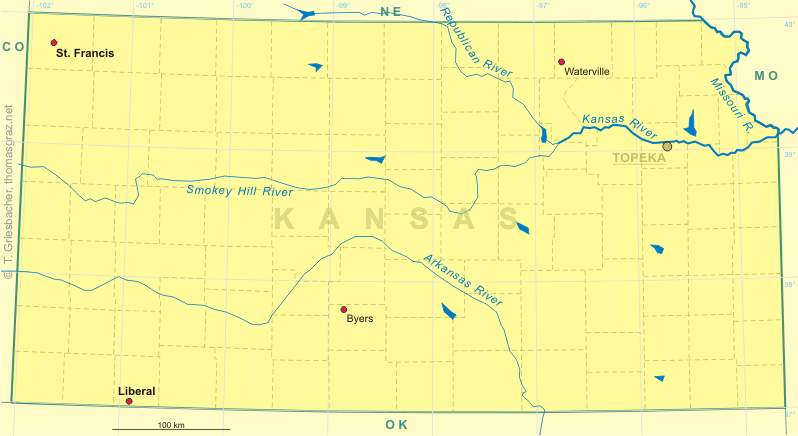
 Liberal, the county seat of Seward county in southwestern Kansas,
is located at an elevation of 2,847 ft (867 m) in the heart of the Great Plains
just three miles from the Oklahoma state line.
As of the 2000 census, the city had a total population of 19,666.
Liberal, the county seat of Seward county in southwestern Kansas,
is located at an elevation of 2,847 ft (867 m) in the heart of the Great Plains
just three miles from the Oklahoma state line.
As of the 2000 census, the city had a total population of 19,666.
The name Liberal goes back to the first homesteader of what later would become this city. Mr. S.S. Rogers was known for giving water for free to passing travelers, which by those who gratefully received this favour was deemed "mighty liberal". When in 1885 Mr. Rogers had opened a general store and the government had established the first official post office, it seemed natural to call the new town "Liberal". In April of 1888, the plat for the present town site was created and 83 plank constructed houses were built in just eighty days. Within a year the population grew to 800 but draught and the opening of the Oklahoma Strip caused a subsequent decline in the population.
In 1920, gas was discovered west of Liberal on what was to become the vast Hugoton Gas Field — the largest gas reserve in the world. In early 1951, oil was discovered southwest of Liberal. During exploration, two layers of gas production below the Hugoton Gas field were discovered, extending life expectancy of gas in this area into the next century.
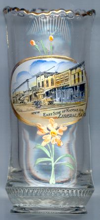
The picture on glass no. 1985 shows the
 east
east
[Text modified from http://www.cityofliberal.com/aboutliberal/history/index.html]
![[scale]](lineal.jpg)