
|
|
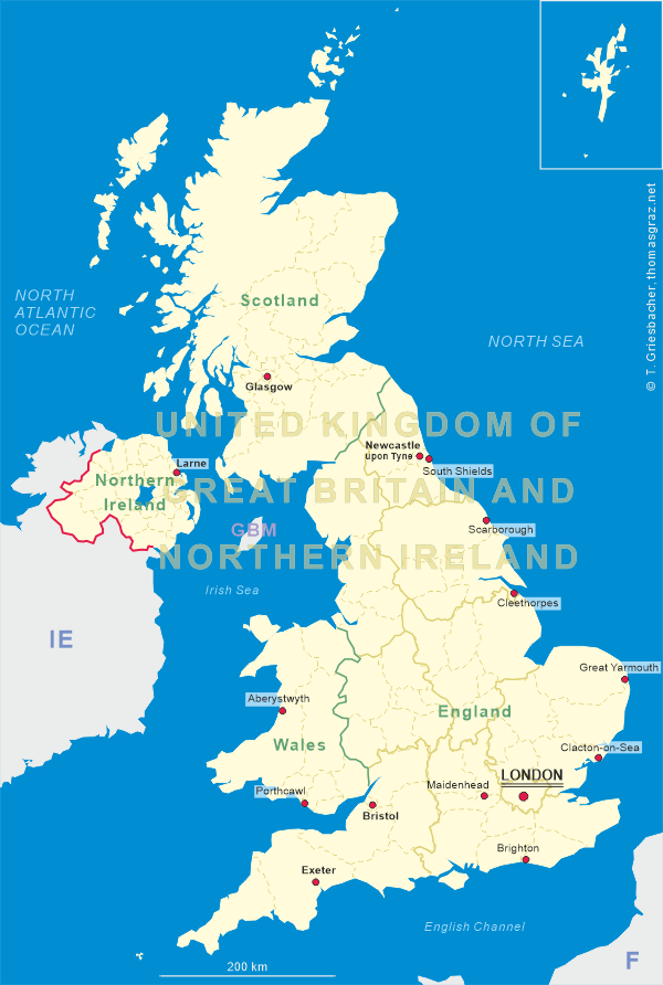
| UNITED KINGDOM OF GREAT BRITAIN AND NORTHERN IRELAND |
| England |
| Region: East of England |
| Shire County: Norfolk |
map →
 Great Yarmouth is located on the eastern coast of England, in the county of Norfolk. Its population is about 46,800 (2001).
Great Yarmouth is the largest town in the borough of Great Yarmouth (population 2003: 92,100).
Great Yarmouth is located on the eastern coast of England, in the county of Norfolk. Its population is about 46,800 (2001).
Great Yarmouth is the largest town in the borough of Great Yarmouth (population 2003: 92,100).
Located near the site of the Roman camp of Gariannonum, Yarmouth (Gernemwa, Yernemuth) is believed to have been the landing-place of Cerdic of Wessex in the 5th century. Soon afterwards, the convenient location attracted many fishermen from the Cinque Ports (Hastings, New Romney, Hythe, Dover, and Sandwich). The permanent settlement that was founded numbered 70 burgesses before the Norman Conquest (1066). Henry I (r.1100–1135) placed it under the rule of a reeve. The charter of King John (1208), which gave his burgesses of Yarmouth general liberties according to the customs of Oxford, was amplified by several later charters asserting the rights of the borough against Little Yarmouth and Gorleston. In 1552 Elizabeth I granted a charter of admiralty jurisdiction, afterwards confirmed and extended by James I (VI of Scotland). In 1668 Charles II incorporated Little Yarmouth in the borough by a charter which with one brief exception remained in force until 1703, when Anne replaced the two bailiffs by a mayor.
Great Yarmouth has been a popular seaside resort since 1760 and is the gateway from the Norfolk Broads to the sea. For hundreds of years it has been dependent on the herring fishery, and today it services the offshore oil rigs. The town suffered during World War II, but much is left of the old town, including the original over 2-km-long protective medieval wall, of which about two-thirds has survived; of the 18 towers, 11 are left. The Tolhouse, complete with dungeons, dates from the late 13th century and is said to be the oldest civic building in Britain.
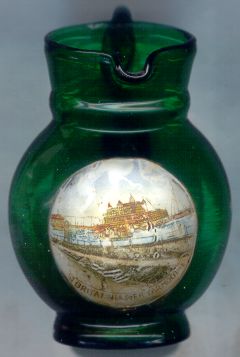
The picture on glass no. 2008 shows
 Britannia
Another glass in this collection is from Yarmouth, Nova Scotia (Canada).
[Texts adapted from http://en.wikipedia.org/wiki/Great_Yarmouth, http://www.great-yarmouth.gov.uk/, http://www.britannia-pier.co.uk/]
![[scale]](lineal.jpg)