
|
|
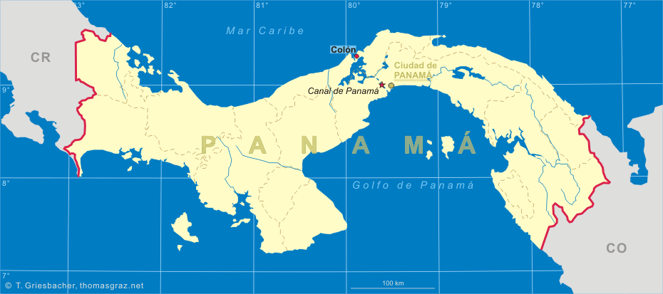
| PANAMÁ | PANAMA |
| provincia: Colón |
map →
 The port town of Colón is situated at the Caribbean coast of Panama, at the Atlantic end of the
Panama Canal. Colón is the capital of the Panamanian province of the same name
and has a population of about 204,000 (2000).
The port town of Colón is situated at the Caribbean coast of Panama, at the Atlantic end of the
Panama Canal. Colón is the capital of the Panamanian province of the same name
and has a population of about 204,000 (2000).
Colón was founded in 1850 as one end of the Panama Railroad which was under construction at the time. The Panama Railroad stretching the isthmus of Panama was the world's first transcontinental railroad. It provided the first convenient connection between the Atlantic and Pacific Oceans. The project was inspired by the California Gold Rush and was begun in 1850. Five years later, the railroad was completed and the first train ran from ocean to ocean on January 28th, 1855. Decades later, the railroad became vital for the construction of the Panama Canal.
In the town's early years it was called Aspinwall by the sizeable United States emigré community while the Hispanic community called it Colón in honor of Christopher Columbus (Cristóforo Colón in Spanish). Much of the city was destroyed by fire during a Colombian civil war in 1885, and again in an accidental fire in 1915. In 1900 the population was some 3,000 people. It grew significantly with the building of the Panama Canal, and was 31,200 in 1920. In 1953 Colón became a Free Trade Zone.
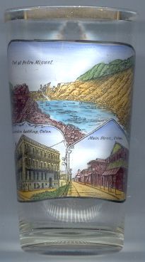
The bottom left picture on glass no. 2072 [left] shows the
 Administration
The bottom right picture shows Main
The top picture shows a view of the construction of the Panama Canal (the cut at
Pedro Miguel).
![[scale]](lineal.jpg)