| DEUTSCHLAND | GERMANY |
| Bundesland: Freistaat Thüringen | Thuringia |
| Kreis: Saale-Holzland-Kreis |
map →
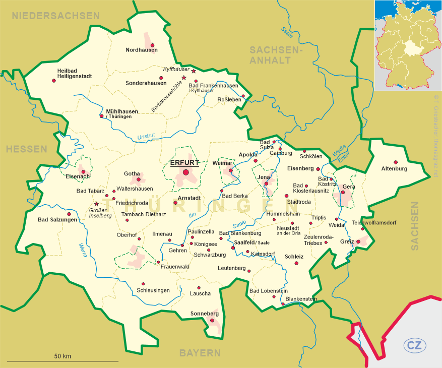
 Hummelshain is situated at an elevation of 359 m in the Saale-Holzland district of eastern Thuringia.
Hummelshain has a population of about 640 (2002) and is one of the 20 communities forming the administrative union
Südliches Saaletal (Southern Saale Valley).
Hummelshain is situated at an elevation of 359 m in the Saale-Holzland district of eastern Thuringia.
Hummelshain has a population of about 640 (2002) and is one of the 20 communities forming the administrative union
Südliches Saaletal (Southern Saale Valley).
It is believed that Hummelshain and Schmölln (today part of Hummelshain) have been founded around 1000 AD. The origin of the name Hummelshain is the name of an ancient Slavic god, 'Hummel' or 'Hommel'. At least since 1516, Hummelshain was a favourite hunting region for the aristocracy.
The administrative union Südliches Saaletal was founded on 23 October 1993 and comprises the communities Altenberga, Bibra, Bucha, Eichenberg, Freienorla, Großeutersdorf, Großpürschütz, Gumperda, Hummelshain, Kleineutersdorf, Laasdorf, Lindig, Milda, Orlamünde, Reinstädt, Rothenstein, Schöps, Seitenroda, Sulza and Zöllnitz. The seat of the administrative union is the city of Kahla, which itself is not part of the administrative union.
The  hunting lodge goes back to a castle that was founded in 1529. In 1664 the castle was
rebuilt as a hunting lodge for the dukes od Saxe-Altenburg (Elder Line). In 1840, the game
reserve was enclosed by a fence since the game animals had become a 'menace' to the farmers of the area.
In 1880–1885 the hunting lodge was rebuilt in representative Renaissance style for Duke Ernst I of
Saxe-Altenburg (Younger Line). It was the penultimate castle to be built in Germany. The tower of the castle has a height
of 48 m and offers a splendid view over the area. The park covers an area of 12 hectares. The castle
and the park are open to the public. The castle also is used for meetigns, festivities and weddings.
hunting lodge goes back to a castle that was founded in 1529. In 1664 the castle was
rebuilt as a hunting lodge for the dukes od Saxe-Altenburg (Elder Line). In 1840, the game
reserve was enclosed by a fence since the game animals had become a 'menace' to the farmers of the area.
In 1880–1885 the hunting lodge was rebuilt in representative Renaissance style for Duke Ernst I of
Saxe-Altenburg (Younger Line). It was the penultimate castle to be built in Germany. The tower of the castle has a height
of 48 m and offers a splendid view over the area. The park covers an area of 12 hectares. The castle
and the park are open to the public. The castle also is used for meetigns, festivities and weddings.
![[scale]](lineal.jpg)