
|
|
| POLSKA | POLAND |
| województwo: Dolnośląskie | voivodship: Lower Silesia |
| powiat: Kamienna Góra | county: Kamienna Góra |
map →
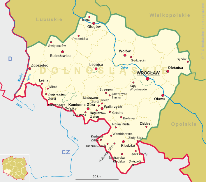
 Kamienna Góra (German name: Landeshut) is situated at an elevation of 468 m on the river Bóbr (Bober)
surrounded by the mountain regions Karkonosze (Riesengebirge, Krkonoše), Rudawy Janowickie (Landeshuter Kamm),
Góry Kamienne and Góry Wałbrzyskie (Waldenburger Bergland), and Góry Krucze (Rabengebirge, Vraní hory).
Kamienna Góra has a population of about 21,700 (2005) and is the administrative seat of the
district of the same name (powiat Kamiennogórski). The Polish name Kamienna Góra literally means 'stone mountain', just like its
Czech name, Kamenná Hora.
Kamienna Góra (German name: Landeshut) is situated at an elevation of 468 m on the river Bóbr (Bober)
surrounded by the mountain regions Karkonosze (Riesengebirge, Krkonoše), Rudawy Janowickie (Landeshuter Kamm),
Góry Kamienne and Góry Wałbrzyskie (Waldenburger Bergland), and Góry Krucze (Rabengebirge, Vraní hory).
Kamienna Góra has a population of about 21,700 (2005) and is the administrative seat of the
district of the same name (powiat Kamiennogórski). The Polish name Kamienna Góra literally means 'stone mountain', just like its
Czech name, Kamenná Hora.
The oldest written mention dates from 1249. In 1392 the town became part of Bohemia. Since 1742 it was part of Prussia. In the 19th century, the city became known for its weaving mills. Tourism started in the late 19th and early 20th century. The railroad from Landeshut via Grüssau (Krzeszów, gmina Kamienna Góra) to Albendorf (Okrzeszyn, gmina Lubawka) was opened in 1899. After World War II, Landeshut became part of Poland and was renamed Kamienna Góra.
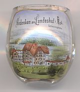
The picture on glass no. 2222 shows a building labeled
 Genesungsheim
![[scale]](lineal.jpg)