
|
|
| DEUTSCHLAND | GERMANY |
| Bundesland: Nordrhein-Westfalen | North Rhine-Westphalia |
| Regierungsbezirk: Arnsberg | |
| Kreis: Märkischer Kreis |
map →
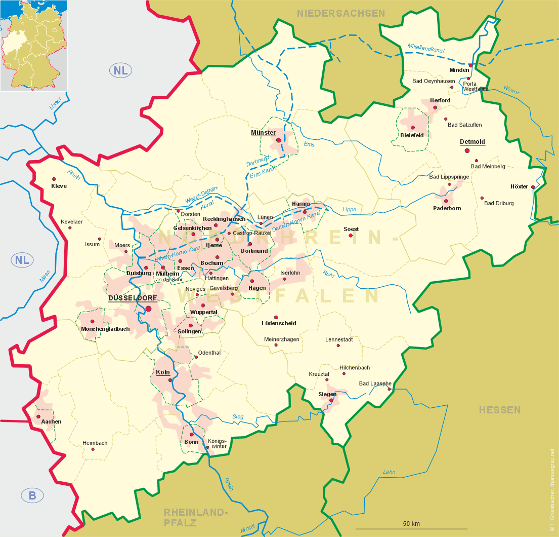
Iserlohn is situated at an elevation of 340 m between the valley of the river Ruhr in the north and the low mountains of the nature reserve Homert in the south. As of 2005, the municipality has a population of about 97,500.
 The 'Bauernkirche' (Peasants' Church) was probably consecrated in 985, and a document of 1059 refers to a village that
might have been located at this place. The earliest undisputed mention of Iserlohn, however, is found in a document
dating from 1150. The name Iserlohn is derived from the Old High German words isen (iron) and
lôh (wood). An earlier document of 1124 mentions the name Iserlohn not for the village, but for the
local area with its iron ore deposits. The city proper, divided into the old town around the Peasants' church and the
citadel town, was founded by Count Engelbert I von der Mark (r. 1247–1277).
The municipal rights of 1237 were confirmed in 1278 by Engelbert's son, Count Eberhard I.
The two parts of the town remained two separate administrative bodies until the early 19th century.
When the Duchy of Jülich, Kleve and Berg was divided in 1609, the county of Mark became
part of Brandenburg (confirmed in 1666). In 1807 it became part of France, and in the following year was incoporated into the
Napoleonic Grand Duchy of Berg. After the Congress of Vienna in 1815,
the Mark was returned to Prussia (administrative region Arnsberg in the province Westfalen).
The manufacturing of wire started as early as the 14th century, the manufacturing of needles began in the late
17th century. Around 1800, Iserlohn and the neighbouring regions around Altena and Lüdenscheid was one of the world's
largest industrial areas of the time.
The so-called Iserlohn Rebellion (Iserlohner Aufstand) was one of the culminating
events of the Revolution of 1848/49.
From 1817 until 1974 Iserlohn was the administrative seat of the district Iserlohn, and from 1907 until 1947 by itself was
administered as a district in its own right. In 1975 Iserlohn was incorporated into the newly-formed district
Märkischer Kreis (administrative seat: Lüdenscheid).
The 'Bauernkirche' (Peasants' Church) was probably consecrated in 985, and a document of 1059 refers to a village that
might have been located at this place. The earliest undisputed mention of Iserlohn, however, is found in a document
dating from 1150. The name Iserlohn is derived from the Old High German words isen (iron) and
lôh (wood). An earlier document of 1124 mentions the name Iserlohn not for the village, but for the
local area with its iron ore deposits. The city proper, divided into the old town around the Peasants' church and the
citadel town, was founded by Count Engelbert I von der Mark (r. 1247–1277).
The municipal rights of 1237 were confirmed in 1278 by Engelbert's son, Count Eberhard I.
The two parts of the town remained two separate administrative bodies until the early 19th century.
When the Duchy of Jülich, Kleve and Berg was divided in 1609, the county of Mark became
part of Brandenburg (confirmed in 1666). In 1807 it became part of France, and in the following year was incoporated into the
Napoleonic Grand Duchy of Berg. After the Congress of Vienna in 1815,
the Mark was returned to Prussia (administrative region Arnsberg in the province Westfalen).
The manufacturing of wire started as early as the 14th century, the manufacturing of needles began in the late
17th century. Around 1800, Iserlohn and the neighbouring regions around Altena and Lüdenscheid was one of the world's
largest industrial areas of the time.
The so-called Iserlohn Rebellion (Iserlohner Aufstand) was one of the culminating
events of the Revolution of 1848/49.
From 1817 until 1974 Iserlohn was the administrative seat of the district Iserlohn, and from 1907 until 1947 by itself was
administered as a district in its own right. In 1975 Iserlohn was incorporated into the newly-formed district
Märkischer Kreis (administrative seat: Lüdenscheid).
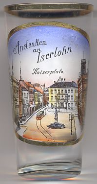
The picture on glass no. 2271 [left] shows a view of the
 Kaiserplatz
![[scale]](lineal.jpg)