
|
|
| FRANCE | FRANCE |
| région: Normandie | Normandy |
| département: 14, Calvados |
map →
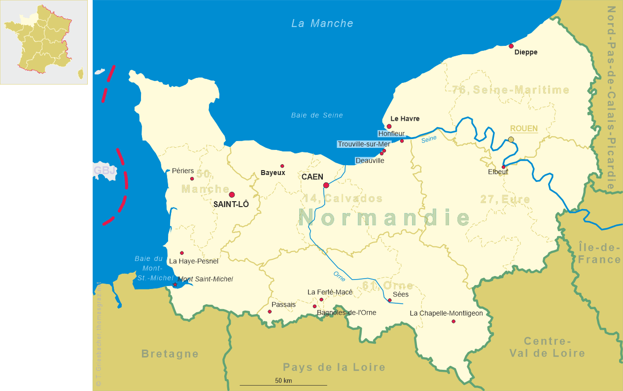
Caen is situated at an elevation of 4 m at the river Orne in Normandy in northern France, about 15 km inland from the English Channel. Caen has a population of about 114,000 (1999) and is the capital (préfecture) of the départment 14, Calvados. Until 31 December 205 it was the capital of the région Basse-Normandie (Lower Normandy). Since the creation on 1 January 2016 of the région Normandie out of the former regions Haute-Normandie and Basse-Normandie, Rouen is the new capital of the new province. However, it is envisaged that Caen will become the seat of the conseil régional de Normandie, which will make it the political centre of Normandie.
 The name Caen is of Celtic origin and means 'battlefield', and throughout its history, the place was indeed the site of heavy fighting.
Caen was the capital of the Duchy of Normandy. William the Conquerer, William II as Duke of Normandy, conquered England in 1066 and became William I
as English king. In Caen, William built the castle and two abbeys, one for monks (the Abbaye aux hommes) and one for nuns (the Abbaye aux dames).
After his death in 1087 near Rouen, William was buried in the Abbaye aux hommes of Caen. However, during the French Revolution his tomb was destroyed and
his bones were lost. Only the tombstone has survived in the abbey church.
In 1346 King Edward III of England led his army against the city, hoping to loot the town, which was the richest in Normandy at the time.
During the Battle of Normandy in World War II Caen was almost completely destoyed.
British and Canadian troops finally conquered the town in 1944. It took until 1962 to rebuild the city.
The name Caen is of Celtic origin and means 'battlefield', and throughout its history, the place was indeed the site of heavy fighting.
Caen was the capital of the Duchy of Normandy. William the Conquerer, William II as Duke of Normandy, conquered England in 1066 and became William I
as English king. In Caen, William built the castle and two abbeys, one for monks (the Abbaye aux hommes) and one for nuns (the Abbaye aux dames).
After his death in 1087 near Rouen, William was buried in the Abbaye aux hommes of Caen. However, during the French Revolution his tomb was destroyed and
his bones were lost. Only the tombstone has survived in the abbey church.
In 1346 King Edward III of England led his army against the city, hoping to loot the town, which was the richest in Normandy at the time.
During the Battle of Normandy in World War II Caen was almost completely destoyed.
British and Canadian troops finally conquered the town in 1944. It took until 1962 to rebuild the city.
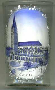
The  church of Saint-Pierre [left, no. 3279] is located in Place
Saint-Pierre in the center of Caen. The construction of the present building took place between the early 13th and the 16th
centuries. The eastern apse of the church was built by Hector Sohier between 1518 and 1545. The interior choir and the
exterior apse display an architecture that embodies the transition from Gothic to Renaissance.
The spire was destroyed on 9 July 1944, by a single 16 inch shell, one of a fifteen-round salvo from the Royal
Navy battleship HMS Rodney aimed at the 12th SS Panzer Division. The tower was reconstructed after the war.
[https://en.wikipedia.org/wiki/Church_of_Saint-Pierre,_Caen]
church of Saint-Pierre [left, no. 3279] is located in Place
Saint-Pierre in the center of Caen. The construction of the present building took place between the early 13th and the 16th
centuries. The eastern apse of the church was built by Hector Sohier between 1518 and 1545. The interior choir and the
exterior apse display an architecture that embodies the transition from Gothic to Renaissance.
The spire was destroyed on 9 July 1944, by a single 16 inch shell, one of a fifteen-round salvo from the Royal
Navy battleship HMS Rodney aimed at the 12th SS Panzer Division. The tower was reconstructed after the war.
[https://en.wikipedia.org/wiki/Church_of_Saint-Pierre,_Caen]
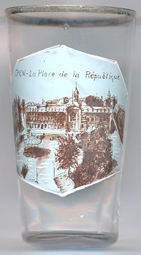 The Place de la République [left, no. 2344] was the centre of
the political and administrative life of Caen. The ensemble was completely destroyed in World War II.
The Hôtel
The Place de la République [left, no. 2344] was the centre of
the political and administrative life of Caen. The ensemble was completely destroyed in World War II.
The Hôtel
![[scale]](lineal.jpg)