
|
|
| DEUTSCHLAND | GERMANY |
| Bundesland: Freistaat Thüringen | Thuringia |
| Landkreis: Saale-Orla-Kreis |
map →
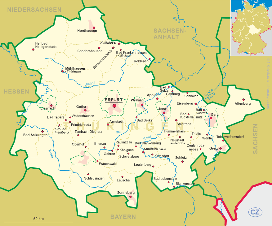
 Blankenstein is situated at an elevation of 450 m on the confluence of the rivers Saale and Selbitz in southern Thuringia,
close to the border to Bavaria. The municipality has a population of about 966 (2006) and is part of
the administrative union Saale-Rennstein.
Blankenstein is situated at an elevation of 450 m on the confluence of the rivers Saale and Selbitz in southern Thuringia,
close to the border to Bavaria. The municipality has a population of about 966 (2006) and is part of
the administrative union Saale-Rennstein.
The first written mention of Blankenstein is found in a document of 1392. Blankenstein is best-known as the starting point of the Rennsteig, a historic route along the summits of the Thuringian Forest mountain region which, in the Middle Ages marked the border between the duchy of Franconia and the Thuringian-Saxon territories.
The  fountain at the hydroelectric power plant on the Selbitz river in the Höllental ('Hell's Valley',
the valley of the river Selbitz above Blankenstein) sprays water up to 36 metres high. The dam was built in 1888. At first, the
dam was used to drive water wheels of a wood mill that produced wood shavings for a paper factory that had been founded in Blankenstein in 1883.
After 1933 the mill was refitted for the generation of electricity. The two turbines and the generator that were installed at that time
are still in use today and produce a maximum power of 900 kW. The fountain is turned on only on Sundays.
fountain at the hydroelectric power plant on the Selbitz river in the Höllental ('Hell's Valley',
the valley of the river Selbitz above Blankenstein) sprays water up to 36 metres high. The dam was built in 1888. At first, the
dam was used to drive water wheels of a wood mill that produced wood shavings for a paper factory that had been founded in Blankenstein in 1883.
After 1933 the mill was refitted for the generation of electricity. The two turbines and the generator that were installed at that time
are still in use today and produce a maximum power of 900 kW. The fountain is turned on only on Sundays.
![[scale]](lineal.jpg)