
|
|
| NEDERLAND | NETHERLANDS |
| Limburg |
map →
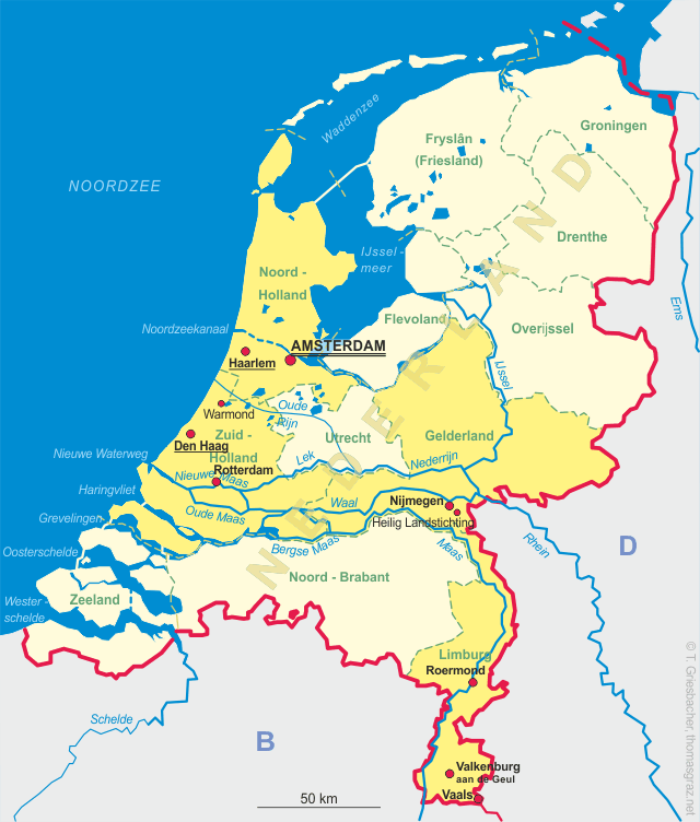
 Vaals is located in the extreme southeast of the Netherlands province Limburg, about 23 km east of Maastricht and 5 km west of
the city centre of Aachen. The municipality has a population of about 10,000 (2006).
Vaals is located in the extreme southeast of the Netherlands province Limburg, about 23 km east of Maastricht and 5 km west of
the city centre of Aachen. The municipality has a population of about 10,000 (2006).
Archaelogical finds demonstrate the presence of human settlements from the linear pottery culture (5300 to 4900 BC). The earliest written document mentioning Vaels (from Latin 'vallis', i.e. valley) dates from 1041. From the Middle Ages up until the Napoleonic period, the area belonged to the duchy of Limburg. After the Congress of Vienna (1815), Vaals became part of the kingdom of the Netherlands whereas Aachen was given to Prussia. After the proclamation of Belgium's independence in 1830, Vaals became Belgian for a short period before it again became part of the Netherlands in 1840. After 1840, the industrial development came to a halt and Vaals became a favourite recreation area of the inhabitants of Aachen. There was even a tram line connecting Vaals and Aachen. During World War II this development came to an abrupt halt in 1940, when the German Wehrmacht occupied the region. After 1948 Vaals again became a very popular shopping place for the Germans. Even today, Vaals has the highest proportion of inhabitants of German citizenship (about 26%).
Glass no. 2455 [left] shows a view of the
 Vaalserberg
![[scale]](lineal.jpg)