
|
|
| ÖSTERREICH | AUSTRIA |
| Bundesland: Steiermark | Styria |
| Bezirk: Leoben |
map →

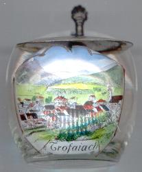
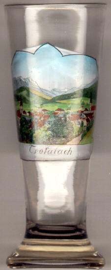 The town of Trofaiach is situated on the old Styrian Iron Road connecting the
iron ore occurances of the Erzberg to the valley of the river Mur. Already in the
Middle Ages hammer mills are documented in Trofaiach.
A decree of 1314 made Leoben the main iron trading place for the region and thus
Trofaiach lost its former importance. Iron smelting from then on concentrated in Vordernberg,
iron trading in Leoben. In 1379 Trofaiach obtained the status of a market town.
A further flowering period of the iron-working industry was the 19th century.
The Erzberg in Eisenerz,
about 20 km to the North, was the largest occurrence of iron ore in Austria-Hungary.
In 1873 the largest furnace of Europe of that time was set up in Niedertrum. This furnace
was still fired with charcoal and operated until 1910. During World War I a large
gunpowder manufacture was set up to the west of the town. Most of the workmen of the factory came from
the gunpowder facilities at Stein (now Kamnik, Slovenia). The factory operated until 1926.
In 1939 the area of the factory became part of the municipality of Trofaiach.
In 1979 Trofaiach was awarded the status of a town.
On 1 January 2013 the neighbouring municipalities of Hafning bei Trofaiach and Gai were incorporated into the municipality of Trofaiach.
The municipality of Vordernberg, originally also planned to be incorporated, had rejected this plan in a plebiscite held in 2012.
The town of Trofaiach is situated on the old Styrian Iron Road connecting the
iron ore occurances of the Erzberg to the valley of the river Mur. Already in the
Middle Ages hammer mills are documented in Trofaiach.
A decree of 1314 made Leoben the main iron trading place for the region and thus
Trofaiach lost its former importance. Iron smelting from then on concentrated in Vordernberg,
iron trading in Leoben. In 1379 Trofaiach obtained the status of a market town.
A further flowering period of the iron-working industry was the 19th century.
The Erzberg in Eisenerz,
about 20 km to the North, was the largest occurrence of iron ore in Austria-Hungary.
In 1873 the largest furnace of Europe of that time was set up in Niedertrum. This furnace
was still fired with charcoal and operated until 1910. During World War I a large
gunpowder manufacture was set up to the west of the town. Most of the workmen of the factory came from
the gunpowder facilities at Stein (now Kamnik, Slovenia). The factory operated until 1926.
In 1939 the area of the factory became part of the municipality of Trofaiach.
In 1979 Trofaiach was awarded the status of a town.
On 1 January 2013 the neighbouring municipalities of Hafning bei Trofaiach and Gai were incorporated into the municipality of Trofaiach.
The municipality of Vordernberg, originally also planned to be incorporated, had rejected this plan in a plebiscite held in 2012.
![[scale]](lineal.jpg)