
|
|
| ČESKÁ REPUBLIKA | CZECH REPUBLIC |
| Královéhradecký kraj | Hradec Králové region |
| Okres: Jičín |
map →
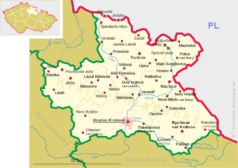
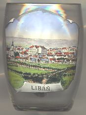 Libáň is situated at an elevation of 238 m about 15 km southwest of the district town Jičín.
The municipality has a population of about 1,700 (2006).
Libáň is situated at an elevation of 238 m about 15 km southwest of the district town Jičín.
The municipality has a population of about 1,700 (2006).
The earliest archeological traces of human settlements date from the Neolithic period and the Bronze Age. Further finds date from The Roman period.
Written records from the 14th century mention the place as Lubaň and Ljuban.
In 1340 Libáň obtained the privileges of a town. Its early history is intimately connected with Staré Hrady castle, whose owners
were also in possession of Libáň. A further flourishing period began when Georg Proskowski of Proskau (today Prószków, PL)
convinced Emperor Maximilian II to confirm the town's privileges. During the 19th century Libáň became an industrial town.
![[scale]](lineal.jpg)