
|
|
| DEUTSCHLAND | GERMANY |
| Bundesland: Freistaat Bayern | Bavaria |
| Regierungsbezirk: Oberbayern | |
| Landkreis: Weilheim-Schongau |
map →

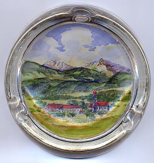 Oberhausen is situated at an elevation of 590–663 m in the district Weilheim-Schongau in the
so-called Pfaffenwinkel region between Weilheim i. OB and
Murnau a. Staffelsee. The municipality has a population of about 2,100 (2009) and
consists of the localities Berg, Achberg, Eyach, Kirnberg, Kreilhof, Maxlried, Sankt Nikolaus, Scheithauf and Thalhausen.
Oberhausen is situated at an elevation of 590–663 m in the district Weilheim-Schongau in the
so-called Pfaffenwinkel region between Weilheim i. OB and
Murnau a. Staffelsee. The municipality has a population of about 2,100 (2009) and
consists of the localities Berg, Achberg, Eyach, Kirnberg, Kreilhof, Maxlried, Sankt Nikolaus, Scheithauf and Thalhausen.
The earliest written mention of Oberhausen dates from AD 950 and is found in a document referring to Berg, today part of
the municipality of Oberhausen,
which at that time was in possession of the bishops of Brixen / Bressanone.
For several centuries, Oberhausen was named
either Hausen unterm Wildenberg or Hausen bei Wildenberg.
The stronghold on the Schlossberg hill, southwest of Oberhausen, from about 1170 was home of the lords of Husen (Hausen).
The family became extinct around 1420; the noble family of Perge owned Berg until the 13th century.
Both Oberhausen and Berg later were part of the possessions of the monastery of Ettal. After the dissolution of the monastery in 1803
its possessions were incorporated into the Electorate (1806 Kingdom) of Bavaria.
![[scale]](lineal.jpg)