
|
|
| FRANCE | FRANCE |
| région: Auvergne-Rhône-Alpes | |
| département: 01, Ain |
map →
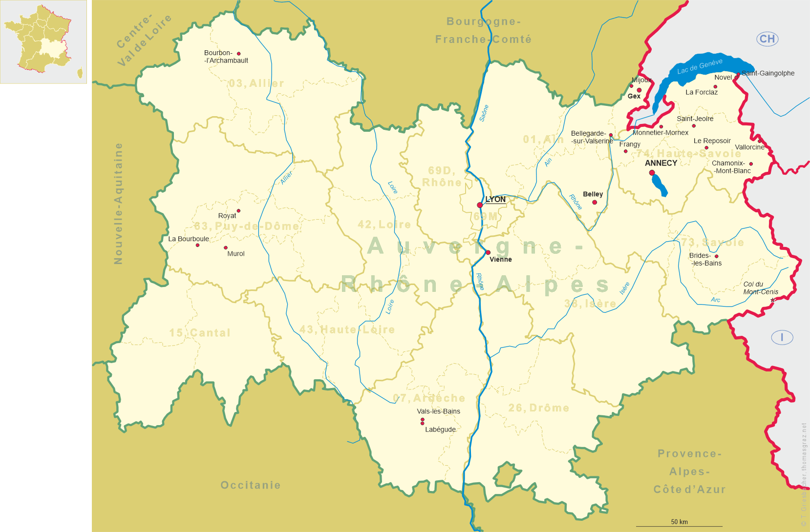
Belley is sitiated at an elevation of 281 m in the south of the départment Ain, région Auvergne-Rhône-Alpes. Belley is the chef-lieu of the arrondissement and the canton of the same name. The municipality has a population of about 8,700 (2007).
 Belley is the historic centre of the Bugey region (Pagus Belliceus). At the end of the 10th century it was part of the Holy Roman Empire,
from the 11th century on it was a dependency of the Counts of Savoy. Anthelme de Chignin, bishop of Belley between 1163 and 1178,
was recognised as a prince Imperial and was one of the main opponents of Count Humbert (Umberto) III of Savoy. In the early 17th century
he became the patron saint of Belley.
After the town had been destroyed by a large fire in 1385 the town was rebuilt with fortifications of which little remains today.
Between 1536 and 1559 Belley was annexed by France for the first time, and under King Henri IV finally became part of France with
the Treaty of Lyon (1607).
At first it was part of the Intendance de Bourgogne, but also became the seat of a Royal Baillage.
Under Napoléon I Belley obtained the status of a sous-préfecture (chef-lieu of an arrondissement).
The diocese of Belley, dissolved during the French Revolution, was re-established in 1823. In 1988 the diocese was renamed Belley-Ars.
Belley is the historic centre of the Bugey region (Pagus Belliceus). At the end of the 10th century it was part of the Holy Roman Empire,
from the 11th century on it was a dependency of the Counts of Savoy. Anthelme de Chignin, bishop of Belley between 1163 and 1178,
was recognised as a prince Imperial and was one of the main opponents of Count Humbert (Umberto) III of Savoy. In the early 17th century
he became the patron saint of Belley.
After the town had been destroyed by a large fire in 1385 the town was rebuilt with fortifications of which little remains today.
Between 1536 and 1559 Belley was annexed by France for the first time, and under King Henri IV finally became part of France with
the Treaty of Lyon (1607).
At first it was part of the Intendance de Bourgogne, but also became the seat of a Royal Baillage.
Under Napoléon I Belley obtained the status of a sous-préfecture (chef-lieu of an arrondissement).
The diocese of Belley, dissolved during the French Revolution, was re-established in 1823. In 1988 the diocese was renamed Belley-Ars.
[Text adapted from
https://de.wikipedia.org/wiki/Belley, http://en.wikipedia.org/wiki/Belley,
https://de.wikipedia.org/wiki/Roman_Catholic_Diocese_of_Belley-Ars]
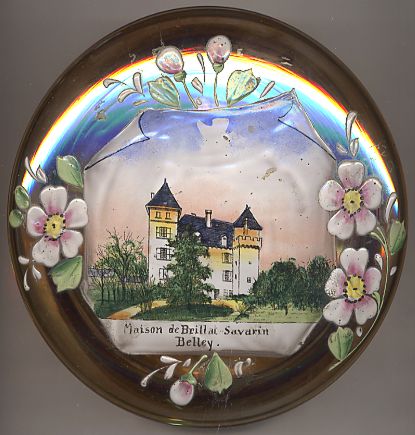
The picture on glass no. 2681 shows a view of the
 maison
![[scale]](lineal.jpg)