
|
|
| ITALIA | ITALY |
| autonome Region: Trentino-Südtirol / regione autonoma: Trentino-Alto Adige | Trentino – South Tyrol |
| autonome Provinz: Bozen – Südtirol / provincia autonoma: Bolzano – Alto Adige |
map →
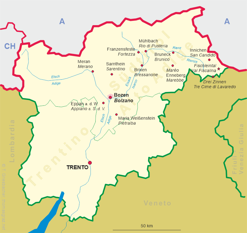
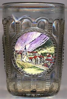
 Franzensfeste (Fortezza) is situated at an elevation of 749 m in the Eisack valley about 19 km south of
Sterzing (Vipiteno) and 11 km north of Brixen (Bressanone). The municipality has a
population of 975 (2010).
Franzensfeste (Fortezza) is situated at an elevation of 749 m in the Eisack valley about 19 km south of
Sterzing (Vipiteno) and 11 km north of Brixen (Bressanone). The municipality has a
population of 975 (2010).
Archeological finds confirm the existence of human habitations at this location dating from about 2,500 BC. When the Romans defeated the Raeti in a battle near Bozen (Bolzano) in 15 BC. the area came under Roman rule. A stretch of the ancient Via Raetia of about 140 m length were discovered in the 1930s and were excavated in 1990–2006. During the War of the Fifth Coalition (1809; Austria and the United Kingdom against France) about 500 freedom fighters under the leadership of Andreas Hofer were defeated here by an army of about 2,500 soldiers from France, Bavaria and Saxony. The historic place later became known as 'Sachsenklemme'. For centuries the place had been an important junction, in the late 19th century connecting the railroad over the Brenner pass (1867) and the railroad through the Puster valley (1871). At first the village was part of the municipality of Mittewald (Mezzaselva), but in 1940 Franzensfeste / Fortezza became the centre of the municipality. Until the 1990s Franzensfeste / Fortezza was an important customs goods station for cattle but with the entry of Austria into the European Union in 1995 has lost its importance. The planned Brenner Base Tunnel, scheduled to be completed by 2025, will have its southern portal at Franzensfeste / Fortezza.
The village obtained its name from the fortress constructed by the Austrians in 1833–1838 und the reigns of Emperors Franz I and Ferdinand I of Austria. The fortress was intended to secure the route from the Brenner pass south. However, the fortress, consisting of the upper, middle and lower fort, was never completed. It also was never involved in any war-like events. The Italian army enlarged parts of the fortress in 1930; further additions including a subterranial part were added beginning in 1940, but these enlargements were also abandoned in 1942. Parts of the lower fort were flooded after the construction of the dam for a hydroelectric power plant. In 2008 the fortress was one of several locations of the European Biennial of contemporary art Manifesta 7.
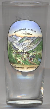
The  railway viaduct across the river Eisack (Isarco) between Franzensfeste / Fortezza
and Aicha / Aica was built for the railroad
connecting Franzensfeste / Fortezza with the Pustertal railroad. The viaduct originally had a length of
204 metres and was supported by 7 arches (maximal height 32 metres).
Two of the pillars still exist today. The last segment connecting the viaduct to the fortress could originally be pulled in order to interrupt the railroad in case
of war.
railway viaduct across the river Eisack (Isarco) between Franzensfeste / Fortezza
and Aicha / Aica was built for the railroad
connecting Franzensfeste / Fortezza with the Pustertal railroad. The viaduct originally had a length of
204 metres and was supported by 7 arches (maximal height 32 metres).
Two of the pillars still exist today. The last segment connecting the viaduct to the fortress could originally be pulled in order to interrupt the railroad in case
of war.
The parish church of the Sacred Heart of Jesus was built in 1898–1899 in Gothic revival style.
[https://de.wikipedia.org/wiki/Franzensfeste, https://de.wikipedia.org/wiki/Festung_Franzensfeste, http://www.fortezzaopenarchive.net/?cat=3]
![[scale]](lineal.jpg)