
|
|
| ÖSTERREICH | AUSTRIA |
| Bundesland: Oberösterreich | Upper Austria |
| Bezirk: Steyr-Land |
map →
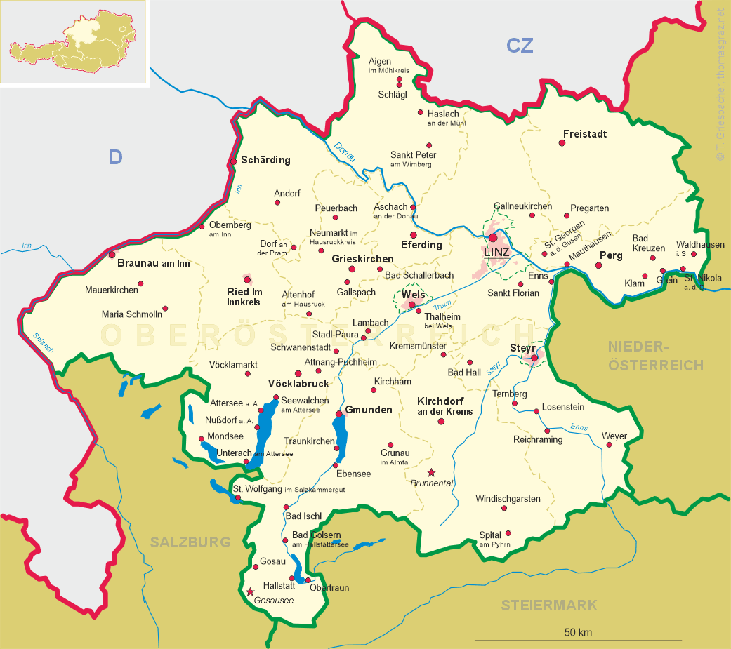
 Ternberg is situated at an elevation of 341 m on the river Enns in southeastern Upper Austria, district Steyr-Land.
The municipality has a population of about 3,350 (2014).
Ternberg is situated at an elevation of 341 m on the river Enns in southeastern Upper Austria, district Steyr-Land.
The municipality has a population of about 3,350 (2014).
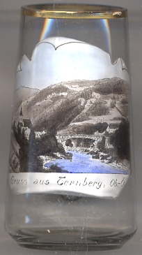
The church in Ternberg were first mentioned in 1100 as a property of the monastery Garsten. Due to its location on the 'Irn Road', a trading route for iron
from the Erzberg in Styria, and the ample availability of water power at the Trattenbach stream,
knife-makers settled here. The guild of pocket-knife makers was founded in 1680. The water-powered hammer mills remained in operation until
prior to World War&nbs;I. Knives are still made today. A popular tourist attraction is the 'Trattenbach Zauckerl', the world's largest pocket knife.
In 1985, Ternberg received the status of a market town.
[https://de.wikipedia.org/wiki/Ternberg, http://www.ternberg.at/system/web/fakten.aspx?gnr_search=12&bezirkonr=0&design=cssnostyle&menuonr=220388352]
The  parish church Sankt Peter und Paul was first mentioned in 1100 as a property of the monastery of Garsten.
It became a parish church in the 14th century. When the monastery of Garsten was dissolved in 1789, Ternberg became an independent parish. Two of the
painted glass windows in the choir date from the 15th century. The Baroque church tower was added in 1757.
[https://de.wikipedia.org/wiki/Pfarrkirche_Ternberg,
http://www.ternberg.at/system/web/fakten.aspx?gnr_search=12&bezirkonr=0&design=cssnostyle&menuonr=220388352,
https://de.wikipedia.org/wiki/Liste_der_denkmalgesch%C3%BCtzten_Objekte_in_Ternberg]
parish church Sankt Peter und Paul was first mentioned in 1100 as a property of the monastery of Garsten.
It became a parish church in the 14th century. When the monastery of Garsten was dissolved in 1789, Ternberg became an independent parish. Two of the
painted glass windows in the choir date from the 15th century. The Baroque church tower was added in 1757.
[https://de.wikipedia.org/wiki/Pfarrkirche_Ternberg,
http://www.ternberg.at/system/web/fakten.aspx?gnr_search=12&bezirkonr=0&design=cssnostyle&menuonr=220388352,
https://de.wikipedia.org/wiki/Liste_der_denkmalgesch%C3%BCtzten_Objekte_in_Ternberg]
![[scale]](lineal.jpg)