
|
|
| ÖSTERREICH | AUSTRIA |
| Bundesland: Niederösterreich | Lower Austria |
| Bezirk: Krems an der Donau |
map →

 Grafenegg is situated at an alevation of 197 m on the Mühlkamp stream in the western part of the Tullnerfeld plain,
about 11 km northeast of Krems an der Donau. The municipality (Etsdorf-Haitzendorf until 2003) has a population of
about 3,000 and consists of the municipal districts Diendorf am Kamp, Engabrunn, Etsdorf am Kamp, Grafenegg, Grunddorf, Haitzendorf, Kamp,
Sittendorf and Walkersdorf am Kamp.
Grafenegg is situated at an alevation of 197 m on the Mühlkamp stream in the western part of the Tullnerfeld plain,
about 11 km northeast of Krems an der Donau. The municipality (Etsdorf-Haitzendorf until 2003) has a population of
about 3,000 and consists of the municipal districts Diendorf am Kamp, Engabrunn, Etsdorf am Kamp, Grafenegg, Grunddorf, Haitzendorf, Kamp,
Sittendorf and Walkersdorf am Kamp.
Diendorf (Tiemindorf) was first mentioned in the 11th century, Engabrunn (Emichinbrunnin) in 1108, Etsdorf (Ozinsdorf) around 1230, Grunddorf (grintdorfh apud Chamba) in 1130, Haitzendorf (curia in Haicendorf) in 1164, Kamp (Chambe) in 1124, Grafenegg (Espersdorf) in 1194 (1450 Grafeneck), Sittendorf in 1139, Walkersdorf (Waltprehstorf) in 1250/1260. Etsdorf became a market town in 1819. The municipality of Etsdorf-Haitzendorf was formed in 1970, Engabrunn was incorporated in 1971. Following a referendum in 2003 the name of the municipality was changed to Grafenegg.
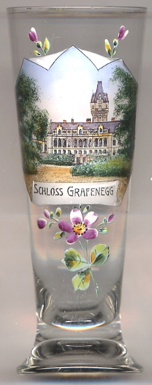
 Grafenegg castle goes back to a yard fortified in the early 15th century.
Around 1500 this structure was remodeled in late Gothic style under the counts of Hardegg.
Between 1622 and 1633 the complex was transformed into a fortified castle. The present shape of the castle was created between 1840 and 1888
when the castle was remodeled in Historicist Gothic and Renaissance revival style. Since 1894 the castle is owned by the House of Ratibor
(dukes of Ratibor and princes of Corvey), a branch of the princes of Hohenlohe.
Grafenegg castle goes back to a yard fortified in the early 15th century.
Around 1500 this structure was remodeled in late Gothic style under the counts of Hardegg.
Between 1622 and 1633 the complex was transformed into a fortified castle. The present shape of the castle was created between 1840 and 1888
when the castle was remodeled in Historicist Gothic and Renaissance revival style. Since 1894 the castle is owned by the House of Ratibor
(dukes of Ratibor and princes of Corvey), a branch of the princes of Hohenlohe.
[https://de.wikipedia.org/wiki/Grafenegg, http://www.grafenegg.gv.at/tourismus/;
https://de.wikipedia.org/wiki/Schloss_Grafenegg]
![[scale]](lineal.jpg)