
|
|
| ČESKÁ REPUBLIKA | CZECH REPUBLIC |
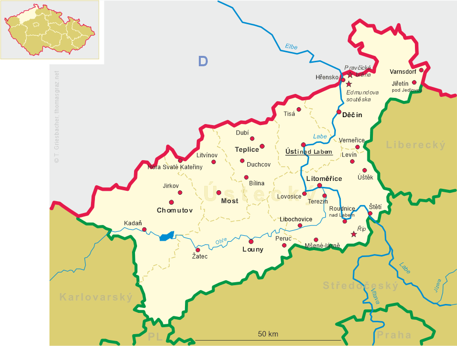
| Ústecký kraj | Ústí nad Labem region |
| Okres: Ústí nad Labem |
map →
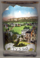 The scattered village Tisá is situated at an atitude of 544–620 m
near the German border at the eastern edge of the Krušné hory (Erzgebirge) mountain range.
The origin of the village is likely to be in the 12th century, the first mentioning in
a document dates from 1340. Tisá became a parish in 1848. Due to the pleasant
surroundings, Tisá is a popular summer holiday resort.
The scattered village Tisá is situated at an atitude of 544–620 m
near the German border at the eastern edge of the Krušné hory (Erzgebirge) mountain range.
The origin of the village is likely to be in the 12th century, the first mentioning in
a document dates from 1340. Tisá became a parish in 1848. Due to the pleasant
surroundings, Tisá is a popular summer holiday resort.
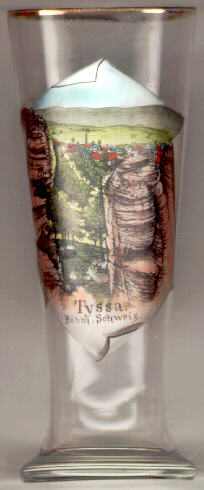 The romantic sandstone cliffs
  Tišské Stěny
(Tisá Walls, Tyssaer Wände) (height up to 70 m) [right] were formed
in the Cretacious period and are the remains of an originally compact sandstone
plateau. This eroded into picturesque rock formations which are known
by names such as Little Cow-shed, Woolfs' Gorge, Knights' Cave, King's Wall,
Rudolph Gate, Nuns, Camel, Pharmacist, Elephants' Legs, Head of Janus, Burgomaster, Hall of Shells.
Tišské Stěny
(Tisá Walls, Tyssaer Wände) (height up to 70 m) [right] were formed
in the Cretacious period and are the remains of an originally compact sandstone
plateau. This eroded into picturesque rock formations which are known
by names such as Little Cow-shed, Woolfs' Gorge, Knights' Cave, King's Wall,
Rudolph Gate, Nuns, Camel, Pharmacist, Elephants' Legs, Head of Janus, Burgomaster, Hall of Shells.
![[scale]](lineal.jpg)