
|
|
| ČESKÁ REPUBLIKA | CZECH REPUBLIC |
| Středočeský kraj | Central Bohemia region |
| Okres: Benešov |
map →
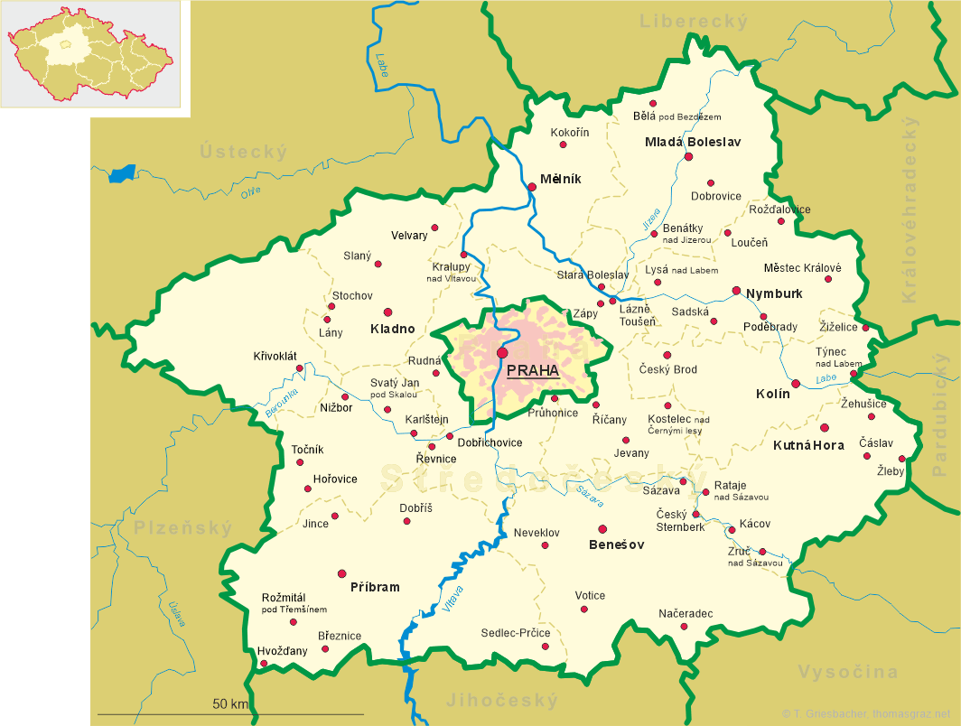
Načeradec is situated at an elevation of 528 m in the Vlašimská pahorkatina (Vlašim hill country) region of Central Bohemia, about 13 km south of Vlašim and 26 km southeast of the district town Benešov. The municipality has a population of about 1,000 (2016).
 Načeradec was first mentioned in a document dating from 1184. The first documented owners of the domains were
the lords of Krumau (Český Krumlov), mentioned as early as 1250.
With the end of manorialism in 1849, Natscheradetz became an independent municipality, at first in the district
Wlaschim (Vlašim), and from 1868 in the district Beneschau (Benešov).
Načeradec was first mentioned in a document dating from 1184. The first documented owners of the domains were
the lords of Krumau (Český Krumlov), mentioned as early as 1250.
With the end of manorialism in 1849, Natscheradetz became an independent municipality, at first in the district
Wlaschim (Vlašim), and from 1868 in the district Beneschau (Benešov).
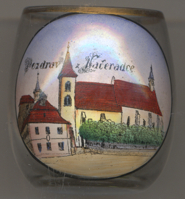
The  church of St. Peter and Paul [left, no. 3159: right]
was built around 1150 in Romanesque style and was modified and enlarged in Gothic style in the 13th/14th century.
In 1734, parts of the church were remodeled in Baroque style.
church of St. Peter and Paul [left, no. 3159: right]
was built around 1150 in Romanesque style and was modified and enlarged in Gothic style in the 13th/14th century.
In 1734, parts of the church were remodeled in Baroque style.
The town hall [left, no. 3159: left]
was built in 1534 and was remodeled in Baroque style in the 18th century.
[https://de.wikipedia.org/wiki/Načeradec]
![[scale]](lineal.jpg)