
|
|
| NORGE / NOREG | NORWAY |
| fylke: Møre og Romsdal | county: Møre og Romsdal |
map →
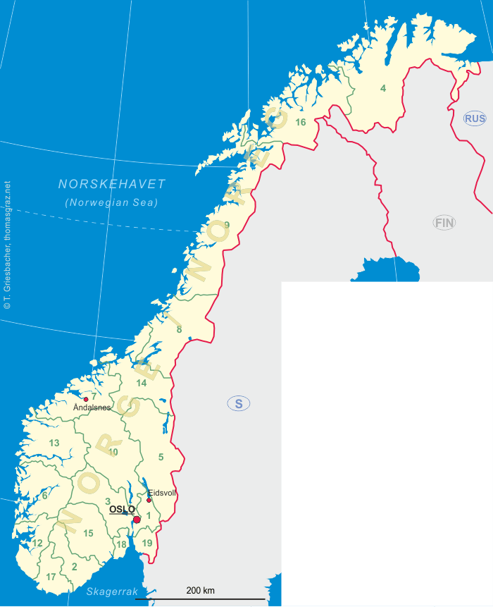
Åndalsnes (until 1921 Aandalsnæs) is situated at the mouth of the river Rauma, at the shores of the Romsdalsfjord on the west coast of Norway. Åndalsnes has a population of about 2,250 (2013). It is also the administratie centre of Rauma Municipality.
The name Aandalsnæs was composed of the farm names Aandal and Næs when
when the mail service to this place opened in 1888; the postmark was changed to the current name Åndalsnes
in 1921. Already in the 19th century, the place was a popular starting point for journeys to Romsdal and the
Romsdalsalpen. The railroad Raumabanen, completed in 1924, connected Åndalsnes to Dombås, the connecting point
for the railroad from Oslo to Trondheim. In 1049, Åndalsnes was almost completely destroyed
by bombs during the German invasion of Norway. The town had to be rebuilt almost entirely after the war.
In 1996 Åndalsnes obtained the status of a city.
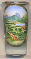
The  Romsdalshornet (1,550 m) [left, background]
is located about 10 km southeast of Aandalsnes, along the Rauma river. Romsdalshornet is a popular mountain for
climbing, which is best done in late summer. Descent by rappel is recommended. The first "official" ascent was
accomplished on 1 September 1881 by the Danish climber, Carl Hall, together with the Norwegians Erik Norahagen
and Mathias Soggemoen. They arrived only to discover a cairn set up by Christen Smed and Hans Bjermeland around 1828.
Previously none believed Romsdalshornet had really been conquered until Hall discovered their cairn.
Romsdalshornet (1,550 m) [left, background]
is located about 10 km southeast of Aandalsnes, along the Rauma river. Romsdalshornet is a popular mountain for
climbing, which is best done in late summer. Descent by rappel is recommended. The first "official" ascent was
accomplished on 1 September 1881 by the Danish climber, Carl Hall, together with the Norwegians Erik Norahagen
and Mathias Soggemoen. They arrived only to discover a cairn set up by Christen Smed and Hans Bjermeland around 1828.
Previously none believed Romsdalshornet had really been conquered until Hall discovered their cairn.
[https://en.wikipedia.org/wiki/Åndalsnes, https://no.wikipedia.org/wiki/Åndalsnes;
https://en.wikipedia.org/wiki/Romsdalshornet]
![[scale]](lineal.jpg)