
|
|
| SLOVENSKO | SLOVAKIA |
| Prešovský kraj | Prešov region |
| okres: Levoča |
map →
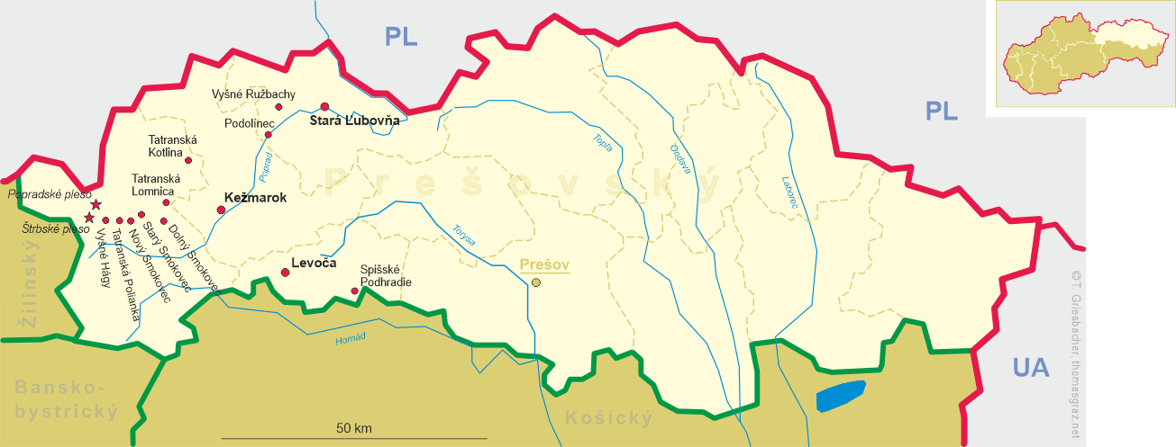
Spišské Podhradie is situated at an elevation of 430 m in the Margecianka river valley in the Spiš (Hungarian: Szepes, German: Zips) region of northeastern Slovakia, about 12 km east of the district town Levoča. The municipality has a population of about 4,000 (2016). The municipality consists of two cadastral districts, Spišské Podhradie (German: Kirchdrauf, Hungarian: Szepesváralja, Polish: Spiskie Podgrodzie), which includes the town quarter Spišská Kapitula (Zipser Kapitel, Szepeshely; merged with Spišské Podhradie in 1948), and Katúň (Kattaun).
 The settlement began to develop in the valley below Spiš Castle
(Spišský hrad), which had been founded in the 12th century. The town's
coat of arms, showing an arm holding a church, originated in the 15th century and is derived from the original German name,
Kirchdorf, later Kirchdrauf; the city restored the use of its historic coat of arms in 1991.
In the second half of the 12th and 13th centuries, German emigrants (the Spiš Saxons) settled in the town.
In 1412, the village was given the status as a town by Sigismund of Luxembourg (at that time
Elector of Brandenburg, German King, King of Hungary and Croatia). Significant further market privileges were give to the
town in 1456. From the 14th century onwards, the town was the seat of many guilds of various crafts. Together with 34 other
towns and villages, Spišské Podhradie was pawned to Poland between 1412 and 1772; after their return, the
town became part of the Province of 16 Spiš towns (1778–1876). In 1894, the town was connected to the
railroad system (railroad from Košice to Bohumín).
In 1662–1665, the settlement around the priory church, Spišská Kapitula, was fortified.
In 1993, Spišské Podhradie with Spišská Kapitula and the village of Žehra were listed
as a UNESCO World Heritage site (extended in 2009 to include the historic centre of
Levoča).
The settlement began to develop in the valley below Spiš Castle
(Spišský hrad), which had been founded in the 12th century. The town's
coat of arms, showing an arm holding a church, originated in the 15th century and is derived from the original German name,
Kirchdorf, later Kirchdrauf; the city restored the use of its historic coat of arms in 1991.
In the second half of the 12th and 13th centuries, German emigrants (the Spiš Saxons) settled in the town.
In 1412, the village was given the status as a town by Sigismund of Luxembourg (at that time
Elector of Brandenburg, German King, King of Hungary and Croatia). Significant further market privileges were give to the
town in 1456. From the 14th century onwards, the town was the seat of many guilds of various crafts. Together with 34 other
towns and villages, Spišské Podhradie was pawned to Poland between 1412 and 1772; after their return, the
town became part of the Province of 16 Spiš towns (1778–1876). In 1894, the town was connected to the
railroad system (railroad from Košice to Bohumín).
In 1662–1665, the settlement around the priory church, Spišská Kapitula, was fortified.
In 1993, Spišské Podhradie with Spišská Kapitula and the village of Žehra were listed
as a UNESCO World Heritage site (extended in 2009 to include the historic centre of
Levoča).
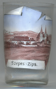
The  Cathedral of St. Martin is the centre of Spišská Kapitula.
The church was built between the 13th and 15th centuries in Romanesque and Gothic styles. It is one of the largest and
most interesting Romanesque monuments in Slovakia. It contains many medieval carved altars and is the resting place of
many lords of Spiš Castle, among them the famous 15th-century carved marble
tombstones of the Zápolya family. A recently restored wall-painting from 1317 depicts the coronation of
Charles Robert of Anjou as King of Hungary (
Cathedral of St. Martin is the centre of Spišská Kapitula.
The church was built between the 13th and 15th centuries in Romanesque and Gothic styles. It is one of the largest and
most interesting Romanesque monuments in Slovakia. It contains many medieval carved altars and is the resting place of
many lords of Spiš Castle, among them the famous 15th-century carved marble
tombstones of the Zápolya family. A recently restored wall-painting from 1317 depicts the coronation of
Charles Robert of Anjou as King of Hungary (
Depicted in the background (top left) is
Spiš castle
[https://de.wikipedia.org/wiki/Spišské_Podhradie, https://en.wikipedia.org/wiki/Spišské_Podhradie,
https://sk.wikipedia.org/wiki/Spišské_Podhradie,
https://sk.wikipedia.org/wiki/Spišský_záloh;
https://en.wikipedia.org/wiki/St_Martin's_Cathedral_(Spišská_Kapitula)]
![[scale]](lineal.jpg)