
|
|
| SCHWEIZ / SUISSE / SVIZZERA / SVIZRA | SWITZERLAND |
| Zürich / Zurich / Zurigo / Turitg |
map →
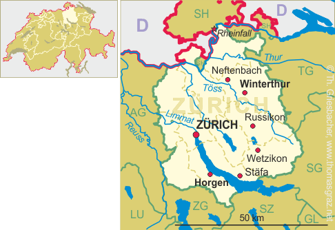
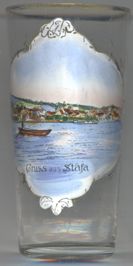 Stäfa is situated at an elevation of 414 m on the northern shore of Lake Zurich in the district
Meilen of the Swiss canton of Zürich. The municipality has a population of about
14,300 (2016) and comprises the villages of Stäfa, Kehlhof and Uerikon as well as the hamlet Mutzmalen.
Stäfa is situated at an elevation of 414 m on the northern shore of Lake Zurich in the district
Meilen of the Swiss canton of Zürich. The municipality has a population of about
14,300 (2016) and comprises the villages of Stäfa, Kehlhof and Uerikon as well as the hamlet Mutzmalen.
The area was already inhabited in the neolithic period. Stäfa was first mentioned in 972 AD as Steveia,
Uerikon in 965 as Urinchova when properties in Uerikon were donated to the monastery of Einsiedeln.
In 1794/1795 clashes between the rural communities and the city of Zurich (the so-called Stäfner Handel) ended with
the military occupation of Stäfa.
[https://de.wikipedia.org/wiki/Stäfa, https://en.wikipedia.org/wiki/Stäfa;
http://mobile.hls-dhs-dss.ch/m.php?lg=d&article=D113.php]
![[scale]](lineal.jpg)