
|
|
| SCHWEIZ / SUISSE / SVIZZERA / SVIZRA | SWITZERLAND |
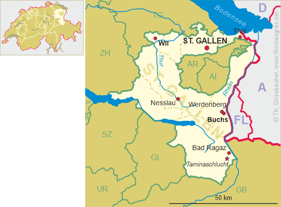
| Sankt Gallen / Saint Gall / San Gallo / Son Gagl |
map →
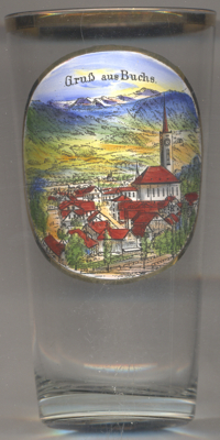 Buchs is situated at an elevation of 448 m on the left bank of the river Rhine which here forms the
border of Switzerland to the neighbouring Principality of Liechtenstein. The municipality of Buchs has a population
of about 12,600 (2017).
Buchs is situated at an elevation of 448 m on the left bank of the river Rhine which here forms the
border of Switzerland to the neighbouring Principality of Liechtenstein. The municipality of Buchs has a population
of about 12,600 (2017).
Buchs was first mentioned as de Pogio in AD 765 in the testament of the bishop of Chur. In 1213 it was mentioned as Buchs, when it was held by the Counts of Werdenberg. From 1404 the Werdenberg estates were a possession of the Counts of Montfort, succeeded by Count John Peter of Sax-Misox in 1483. In 1517 the area was acquired by the citizens of Glarus who implemented the Protestant Reformation. Buchs was incorporated into the Canton of Linth of the short-lived Napoleonic Helvetic Republic from 1798 to 1803, when it passed to the newly established Canton of Sankt Gallen.
The  Reformed church [centre right
] was built in 1931/1932.
Reformed church [centre right
] was built in 1931/1932.
Buchs is the birthplace of Heinrich Rohrer (1933–2013) who sharedhalf of the 1986 Nobel Prize in Physics
with Gerd Binnig for the design of the scanning tunneling micicroscope (the other half of the Prize was awarded to
Ernst Ruska).
[https://de.wikipedia.org/wiki/Buchs_SG, https://en.wikipedia.org/wiki/Buchs,_St._Gallen;
https://en.wikipedia.org/wiki/Heinrich_Rohrer]
![[scale]](lineal.jpg)