
|
|
| ČESKÁ REPUBLIKA | CZECH REPUBLIC |
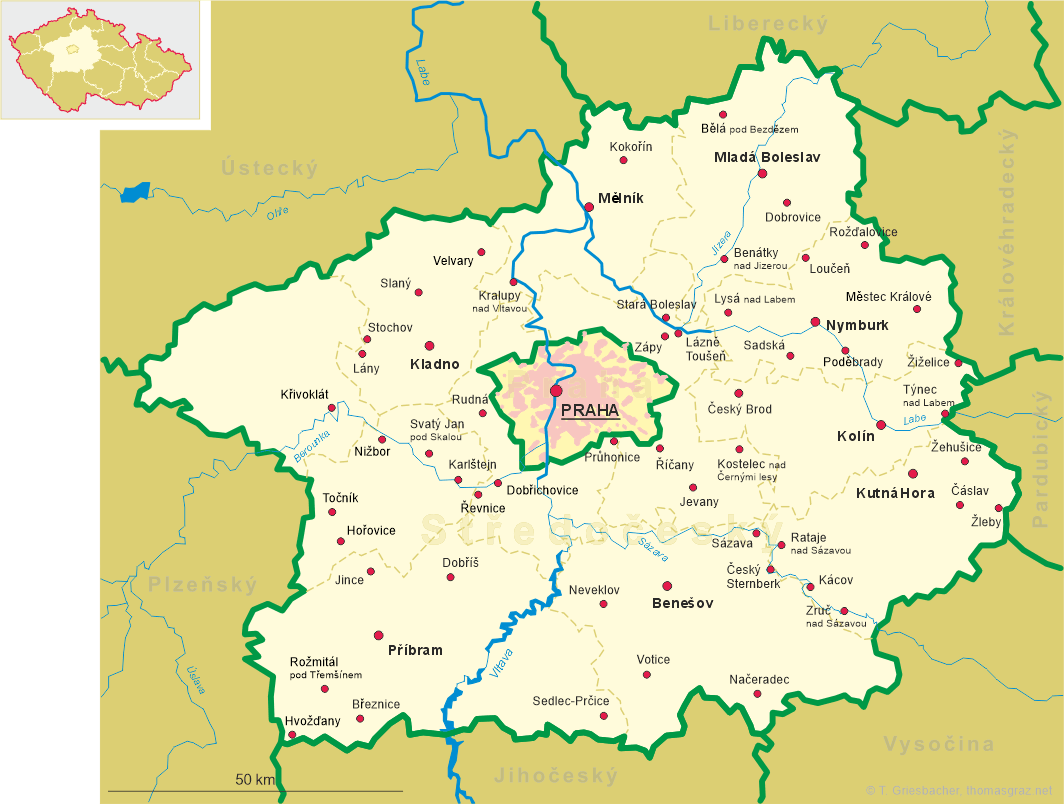
| Středočeský kraj | Central Bohemia region |
| Okres: Beroun |
map →
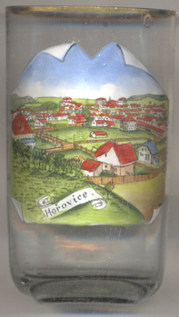 Hořovice is situated at an elevation of 375 m on the stream Červeny potok, about halfway between
Prague and Plzeň between the nature reserves
Křivoklátsko (with Křivoklát, Český kras (Bohemian
karst), and the foothills of the Brdská vrchovina mountains. The municipality has a population of about 6,800
(2018).
Hořovice is situated at an elevation of 375 m on the stream Červeny potok, about halfway between
Prague and Plzeň between the nature reserves
Křivoklátsko (with Křivoklát, Český kras (Bohemian
karst), and the foothills of the Brdská vrchovina mountains. The municipality has a population of about 6,800
(2018).
Archaeological finds demonstrate that the area had already been settled in the 10th century. This settlement grew at the end of the 13th century and beginning of the 14th century when a trading post was established. This trading post was later rebuilt and expanded into a castle in Gothic style (the so-called "Old Castle"). The lords of Hořovice were first mentioned in 1233. In 1322 Hořovice obtained the status of a town. The "Old Castle" and the church remained outside of the town walls, forming the borough of Velká Víska. This division remained until the 20th century; in 1919 Velká VíMska became a part of Hořovice. Until 1960 the town was the administrative seat of the district Hořovice.
The common Jewish surnames Horovitz, Horowitz, Gurvich, Hurwicz, Hurwitz etc. derive from
Hořovice, which during the late Middle Ages had a substantial Jewish population.
[https://de.wikipedia.org/wiki/Hořovice, https://en.wikipedia.org/wiki/Hořovice]
![[scale]](lineal.jpg)