
|
|
| DEUTSCHLAND | GERMANY |
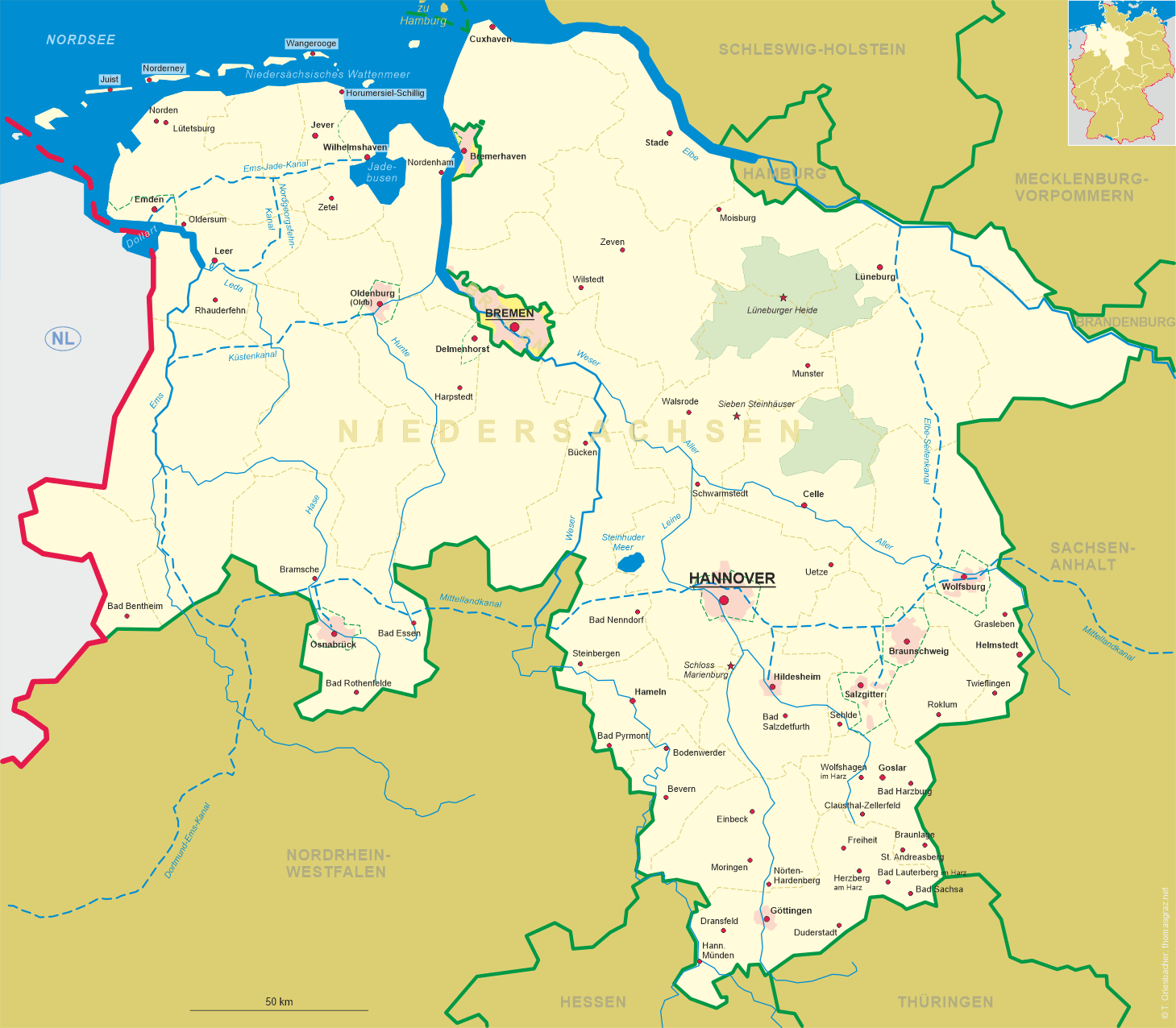
| Bundesland: Niedersachsen | Lower Saxony |
| Landkreis: Goslar |
map →
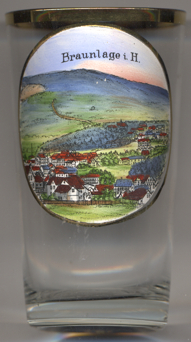 Braunlage is situated at an elevation of 620 m within the Harz mountain range, south of the
Brocken massif. The municipality has a population of about 5,900 (2018) and consists of the
non-contiguous parts of Braunlage, Hohegeiß and Sankt Andreasberg, which are separated from each other by parts of
the unincorporated area Harz in the south of the district Goslar.
Braunlage is situated at an elevation of 620 m within the Harz mountain range, south of the
Brocken massif. The municipality has a population of about 5,900 (2018) and consists of the
non-contiguous parts of Braunlage, Hohegeiß and Sankt Andreasberg, which are separated from each other by parts of
the unincorporated area Harz in the south of the district Goslar.
First mentioned as Brunla in 1227, the town started out as a pit settlement in the Harz forests. It appeared as
Brunenlo in a 1253 register of the Saxon counts of Regenstein and was revived, when their successors, the Counts of
Blankenburg, established an ironworks here in 1561. With the extinction of the Blankenburg dynasty in 1599, Braunlage fell
to the Dukes of Braunschweig-Wolfenbüttel. Tourism developed from the late 19th century
onwards. After World War II, Braunlage was located close to the fortified inner German border which ran through the
Harz mountains. Since German reunification in 1990, Braunlage again is located in the centre of the Harz touristic region,
however, it had to cope with growing competition by the neighbouring resorts in Saxony-Anhalt.
[https://de.wikipedia.org/wiki/Braunlage, https://en.wikipedia.org/wiki/Braunlage]
![[scale]](lineal.jpg)