
|
|
| DEUTSCHLAND | GERMANY |
| Bundesland: Rheinland-Pfalz | Rhineland-Palatinate |
| Landkreis: Rhein-Lahn-Kreis |
map →
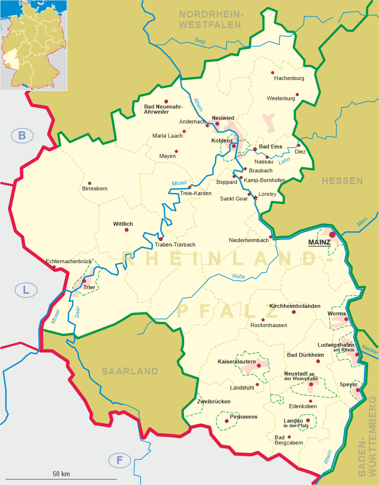
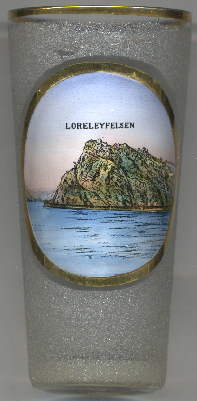 The Loreley, also spelled Lorelei in English, is a 132 m high, steep slate rock on the right bank of the
river Rhine in the Rhine Gorge (or Middle Rhine) at Sankt Goarshausen. it is part of the Upper Middle Rhine Valley UNESCO
World Heritage Site (see list of other world heritage sites depicted on glasses of this
collection).
The Loreley, also spelled Lorelei in English, is a 132 m high, steep slate rock on the right bank of the
river Rhine in the Rhine Gorge (or Middle Rhine) at Sankt Goarshausen. it is part of the Upper Middle Rhine Valley UNESCO
World Heritage Site (see list of other world heritage sites depicted on glasses of this
collection).
The name comes from the old German words lureln, Rhine dialect for 'murmuring', and the Celtic term ley, 'rock'. The translation of the name would therefore be: 'murmur rock' or 'murmuring rock'. The heavy currents, and a small waterfall in the area (still visible in the early 19th century) created a murmuring sound, and this combined with the special echo the rock produces to act as a sort of amplifier, giving the rock its name. The murmuring is hard to hear today owing to the urbanization of the area. Other theories attribute the name to the many boating accidents on the rock, by combining the German verb lauern ('to lurk, lie in wait') with the same 'ley' ending, with the translation 'lurking rock'.
The administrative union Loreley comprises the municipalities Auel, Bornich, Braubach, Dachsenhausen, Dahlheim,
Dörscheid, Filsen, Kamp-Bornhofen, Kaub, Kestert, Lierschied, Lykershausen, Nochern, Osterspai,
Patersberg, Prath, Reichenberg, Reitzenhain, Sauerthal, Sankt Goarshausen, Weisel and Weyer. The saet of the administration is in
Sankt Goarshausen.
[https://en.wikipedia.org/wiki/Lorelei]
![[scale]](lineal.jpg)