
|
|
| ÖSTERREICH | AUSTRIA |
| Bundesland: Kärnten | Carinthia |
| Bezirk: Spittal an der Drau |
map →
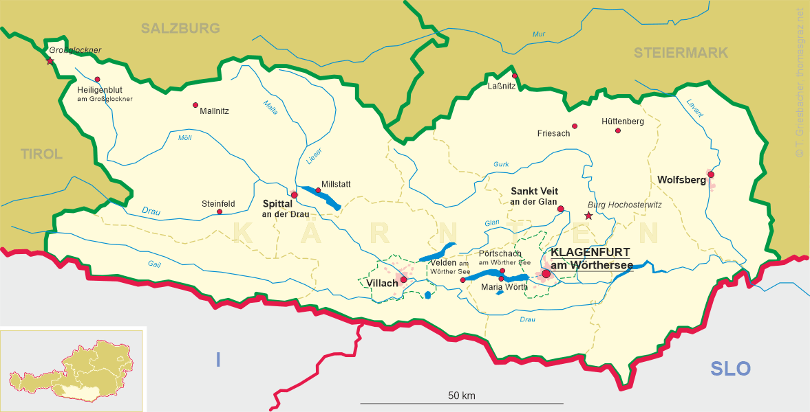
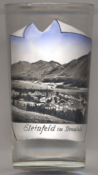 Steinfeld is situated at an elevation of 617 m in the upper Drau valley, about 25 km west of the district town
Spittal an der Drau. The municipality has a population of about 2,000 (2021).
Steinfeld is situated at an elevation of 617 m in the upper Drau valley, about 25 km west of the district town
Spittal an der Drau. The municipality has a population of about 2,000 (2021).
The earliest known written document that mentions Steinfeld dates from 1267/1268. Mining for gold and later iron became important from from
the 15th century onward, but already in the 17th century declined. The mining activities were finally stopped in at the beginning
of the 20th century. The municipality was founded in 1850. The construction of the railway in the Drau valley in the late 19th century
and the associated settlement of woodworking companies was an important impulse for the development of the community. In the course of the
20th century, summer tourism and gastronomy also developed into important economic sectors in the municipality. In 1930, Steinfeld obtained
the official status as a market town.
[https://de.wikipedia.org/wiki/Steinfeld_(K%C3%A4rnten);
https://at.wikiqube.net/wiki/spittal_an_der_drau_district]
![[scale]](lineal.jpg)