
|
|
| ČESKÁ REPUBLIKA | CZECH REPUBLIC |
| Karlovarský kraj | Karlovy Vary region |
| Okres: Karlovy Vary |
map →
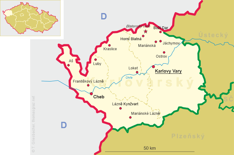
 Horní Blatná is situated at an elevation of 902 m in a flat depression west of the ridge plateau of the Bohemian
Ore Mountains (Krušné hory) on the southwest slope of the mountain Blatenský vrch in the district
Karlovy Vary. As of January 2021, the municipality has a population of 389.
Horní Blatná is situated at an elevation of 902 m in a flat depression west of the ridge plateau of the Bohemian
Ore Mountains (Krušné hory) on the southwest slope of the mountain Blatenský vrch in the district
Karlovy Vary. As of January 2021, the municipality has a population of 389.
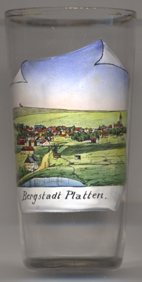
Platten was founded by miners coming from Schneeberg in Saxony who in 1532 had opened a tin mine on the Plattenberg (Blatenský vrch). In 1534, Elector Johann Friedrich of Saxony ordered the planned construction of a new mountain (mining) town on the ridge of the Ore Mountains. The new town was laid out like a chessboard based on the model of Marienberg, which had been founded only in 1521. Due to the Capitulation of Wittenberg of 1547, which ended the Schmalkaldic War, Platten was ceded to the Kingdom of Bohemia. The predominantly Protestant population was forced to leave the town in 1653 under the pressure of the Counter-Reformation; a large part went over the Saxon border and founded Johanngeorgenstadt in 1654. The city was repopulated from the interior of Bohemia, but never regained its former size and importance. After the revolution of 1848/1849 and the following abolition of manorialism, the modern municipality was founded in 1850 and became the seat of the district Platten but in 1910 was incorporated into the district Neudek (today Neydek). After the World War I, Bergstadt Platten (official name since 1918) became part of the newly created Czechoslovakia in 1919. Following the Munich Agreement of 1938, the place was annexed to the German Reich and until 1945 belonged to the administrative district of Eger (today Cheb) in the Reichsgau Sudetenland. After the end of World War II, it was returned to Czechoslovakia, and the German population was subsequently expelled. The mining region of Horní Blatná is part of the UNESCO World Cultural Heritage site Erzgebirge/Krušhoří (Ore Mountains) Mining Region, listed in 2019 and including, on the Czech side, the Krupka Mining Cultural Landscape, the Jáchymov Mining Landscape, the Abertamy – Boží Dar – Horní Blatná Mining Landscape, the Mining Landscape at the peak of Medník, and the Red Tower of Death in Vykmanov. (see also list of other UNESCO heritage sites depicted on glasses of this collection)
Other glasses of this collection show views of Blatná in South Bohemia.
[https://de.wikipedia.org/wiki/Horn%C3%AD_Blatn%C3%;
https://www.visitczechrepublic.com/en-US/7087038c-97b7-4583-909c-1e8457b02bb6/place/c-krusnohori-erzgebirge-mining-region-unesco]
![[scale]](lineal.jpg)