
|
|
| ÖSTERREICH | AUSTRIA |
| Bundesland: Niederösterreich | Lower Austria |
| Bezirk: Sankt Pölten |
map →

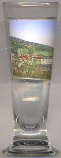
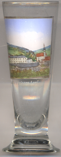 The summer holday resort and residential district Purkersdorf is situated at an elevation of 246 m in the valley
of the river Wien west of Vienna. The first mentioning in a document dates from 1130
(Purchartesdorf). The village was destroyed by the Turks in 1683. The plague of 1713 killed 80% of the population
of that time. In 1930 Purkersdorf received the status of a market town. Between 1938 and 1954 Purkersdorf was part of
Vienna (Groß-Wien, Greater Vienna, 14th district, Penzing). Since 1966 Purkersdorf
has the status of a town.
The summer holday resort and residential district Purkersdorf is situated at an elevation of 246 m in the valley
of the river Wien west of Vienna. The first mentioning in a document dates from 1130
(Purchartesdorf). The village was destroyed by the Turks in 1683. The plague of 1713 killed 80% of the population
of that time. In 1930 Purkersdorf received the status of a market town. Between 1938 and 1954 Purkersdorf was part of
Vienna (Groß-Wien, Greater Vienna, 14th district, Penzing). Since 1966 Purkersdorf
has the status of a town.
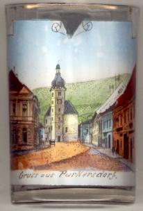 The Gothic and Baroque
  parish church Sankt Jakobus der Ältere (St. James the
Greater) goes back to a church of the 12th century. The parish was first mentioned in 1349. Since 1727 it is a
pilgrimage church, known in the 18th and 19th century as Maria Purkersdorf.
parish church Sankt Jakobus der Ältere (St. James the
Greater) goes back to a church of the 12th century. The parish was first mentioned in 1349. Since 1727 it is a
pilgrimage church, known in the 18th and 19th century as Maria Purkersdorf.
![[scale]](lineal.jpg)