
|
|
| ČESKÁ REPUBLIKA | CZECH REPUBLIC |
| Zlínský kraj | Zlín region |
| Okres: Vsetín |
map →
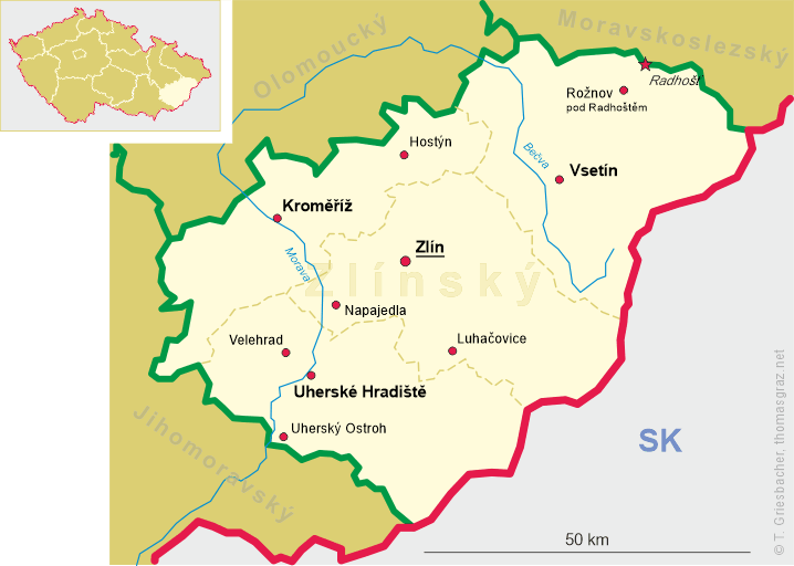
 Vsetín is situated at an elevation of 342 m on the Vsetínska Bečva, the left source of the river Bečva,
in a hilly landscape about 27 km northeast of the regional capital, Zlín. Vsetín is the administrative
centre of the district of the same name. The municipality has a population of about 25,800 (2021).
Vsetín is situated at an elevation of 342 m on the Vsetínska Bečva, the left source of the river Bečva,
in a hilly landscape about 27 km northeast of the regional capital, Zlín. Vsetín is the administrative
centre of the district of the same name. The municipality has a population of about 25,800 (2021).
The first written mention of the area around the Bečva river is from 1297, when Vsetín itself did not yet exist. The first written mention of Setteinz dates from 1308. In following decades, Vsetín was held by many noble families. A fortress was built in the first half of the 15th century. In 1609, Vsetín was acquired by marriage by Albrecht von Wallenstein. He initiated a strict re-Catholicisation among serfs. Religious and economic oppression led to resistance and long-term rebellions of the serfs during the Thirty Years' War (1618–1648). The serfs joined the Swedish army in the war and Vsetín became their centre. In 1627, Vsetín was burned down but the rebels weren't defeated until 1644. Between 1663 and 1683,and again in 1708, Vsetín was devastated by the Turkish and Tartarish raids, followed by Hungarian rebels. In 1849, the Upper and Lower Towns merged. In the late 19th century, Vsetín became an important centre of industrial production of bent-wood furniture. In 1885 the town was linked to an inland railway system. In 1909, Vsetín became a district town and its importance grew in parallel with its economic boom.
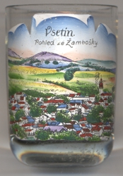
The picture on glass no. 4273 [left] is labeled Pohled ze Žambošky, i.e. 'view from Žamboška',
which is located about 2 km northeast of Vsetín and today is part of the municipality.
[https://de.wikipedia.org/wiki/Vset%C3%ADn, https://en.wikipedia.org/wiki/Vset%C3%ADn]
![[scale]](lineal.jpg)