
|
|
| ČESKÁ REPUBLIKA | CZECH REPUBLIC |
| Středočeský kraj | Central Bohemia region |
| Okres: Kutná Hora |
map →
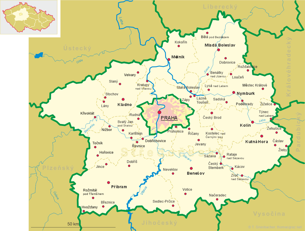
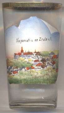 Zruč nad Sázavou is situated at an elevation of 344 m in the Žilvka highlands on the river Sázava,
about 51 km southeast of Prague in Central Bohemia. The municipality has a population of about 4,800 (2021).
Zruč nad Sázavou is situated at an elevation of 344 m in the Žilvka highlands on the river Sázava,
about 51 km southeast of Prague in Central Bohemia. The municipality has a population of about 4,800 (2021).
The first written record dates from 1334. However, it is assumed that the settlement was originally founded e as early as the 11th century, after
the monastery in Sázava was built. The first known owners were the counts Kolowrat. The town expereinced its first boom
after the Kalenic had bought the village in 1551. tt was finally granted the status of a town in 1651. During the Thirty Years' War (1618&ndasp;1648)
the village fell into disrepair and in the years that followed it experienced a frequent change of owners. At the end of the 19th century there was
a new boom and the town was connected to the road and rail network. In 1939, the Baťa shoe company built a factory here and the town became known
as an industrial centre. The footwear production lasted until 1997.
[https://de.wikipedia.org/wiki/Zru%C4%8D_nad_S%C3%A1zavou, https://en.wikipedia.org/wiki/Zru%C4%8D_nad_S%C3%A1zavou]
![[scale]](lineal.jpg) contact: webmaster
contact: webmaster