
|
|
| ČESKÁ REPUBLIKA | CZECH REPUBLIC |
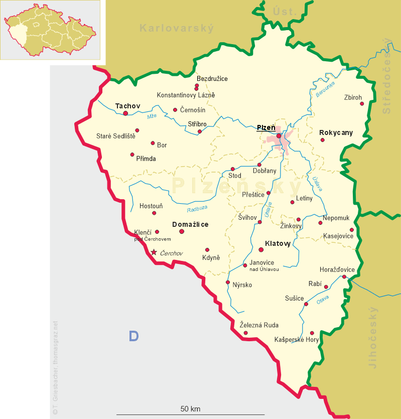
| Plzeňský kraj | Plzeň region |
| Okres: Klatovy |
map →
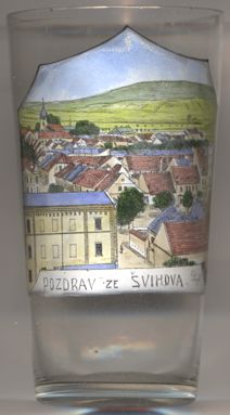 Švihov is situated at an elevation of 374 m in the Úhlava valley of western Bohemia, about 10 km north of the district town
Klatovy and about 29 km southwest of the regional capital Plzeň. The municipality has a population
of about 1,700 (2023).
Švihov is situated at an elevation of 374 m in the Úhlava valley of western Bohemia, about 10 km north of the district town
Klatovy and about 29 km southwest of the regional capital Plzeň. The municipality has a population
of about 1,700 (2023).
The first written mention of Švihov dates from 1245, however, a manor house probably existed here already in 1194. In the first half of the 14th century, a fortress was built here and Švihov would become the centre of a large estate. In 1367, švihov was referred to as a town for the first time, but due to the proximity of Klatovy, it remained insignificant. A massive castle was built in place of the old fortress in the 1480s. Since 1598 it was in possession of the Czernin family. However, the castle ceased to be a feudal seat and the importance of the town declined. During the Thirty Years' War (1618–1648), the Swedish army plundered the town, but failed to capture the castle. Emperor Ferdinand III ordered the demolition of the castle in 1655, but due to delays that never happened. However, the castle remained uninhabited, and in 1662 it was described as ruined. Its premises were used as granaries from the 18th century, which saved it from complete destruction. The Czernin family owned Švihov until 1918.
The  church of St. Wenceslas [left, no. 4464: background left] was originally a Gothic building. After it
was damaged by a fire, it was completely rebuilt in the late Baroque style in 1744–1747, probably by František Maxmilián Kaňka.
church of St. Wenceslas [left, no. 4464: background left] was originally a Gothic building. After it
was damaged by a fire, it was completely rebuilt in the late Baroque style in 1744–1747, probably by František Maxmilián Kaňka.
[https://de.wikipedia.org/wiki/%C5%A0vihov_u_Klatov, https://en.wikipedia.org/wiki/%C5%A0vihov_(Klatovy_District)]
![[scale]](lineal.jpg)