
|
|
| ČESKÁ REPUBLIKA | CZECH REPUBLIC |
| Karlovarský kraj | Karlovy Vary region |
| Okres: Cheb |
map →
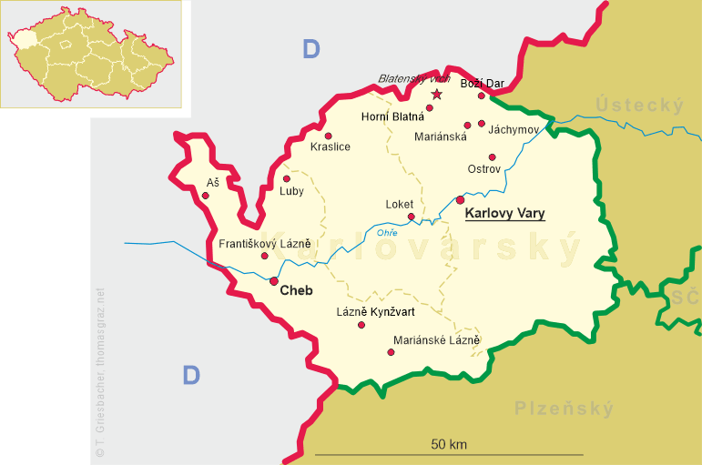
 Luby is situated at an elevation of 518 m the Bohemian part of the historic Vogtland region that today is divide between the German states of
Bavaria, Saxony and Thuringia and north-western Bohemia, about 10 km northeast of the district town Cheb and about 33 km
west of the regional capital Karlovy Vary. The municipality has a population of about 2,200 (2023).
Luby is situated at an elevation of 518 m the Bohemian part of the historic Vogtland region that today is divide between the German states of
Bavaria, Saxony and Thuringia and north-western Bohemia, about 10 km northeast of the district town Cheb and about 33 km
west of the regional capital Karlovy Vary. The municipality has a population of about 2,200 (2023).
The area was probably settled between 1100 and 1140. The first written mention of Luby dates from 1158 when it was in possession of the abbey of
Waldsassen. The village was promoted to a town in 1319 and in 1354 it became a royal property. During the mid-13th century, mercury ore, particularly the
vermilion variety, was mined in the area of Horní Luby. In the 16th century, the ore was regarded as the most important in Central Europe. During the
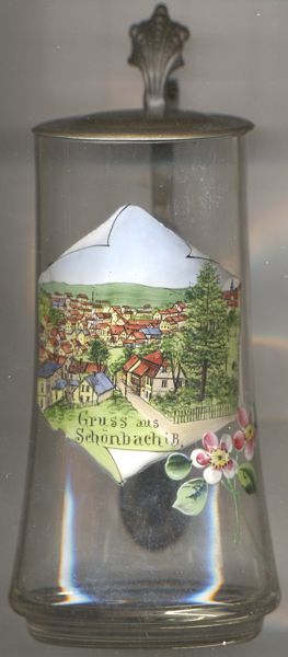
Thirty Years' War (1618–1648), mining came to a complete standstill. However, in the latter half of the 17th century, Schönbach flourished as
a centre of violin making. After World War II, the German name Schönbach was officially changed to the Czech name Luby. The remaining
German-speaking inhabitants (about two-thirds of the population at the time) were expelled in 1949. The instrumentmakers among them mostly settled in
Bubenreuth near Erlangen in Germany.
[https://de.wikipedia.org/wiki/Luby, https://en.wikipedia.org/wiki/Luby_(Cheb_District)]
https://www.deutsche-digitale-bibliothek.de/item/ESKIA6HTICGILO5BULLBKVKHOJNHN2WY, https://knihovna.muzeumcheb.cz/records/87627300-7809-468a-a1c2-080d11ad31f2?locale=de]
![[scale]](lineal.jpg)