
|
|
| ÖSTERREICH | AUSTRIA |
| Bundesland: Kärnten | Carinthia |
| Bezirk: Spittal an der Drau |
map →
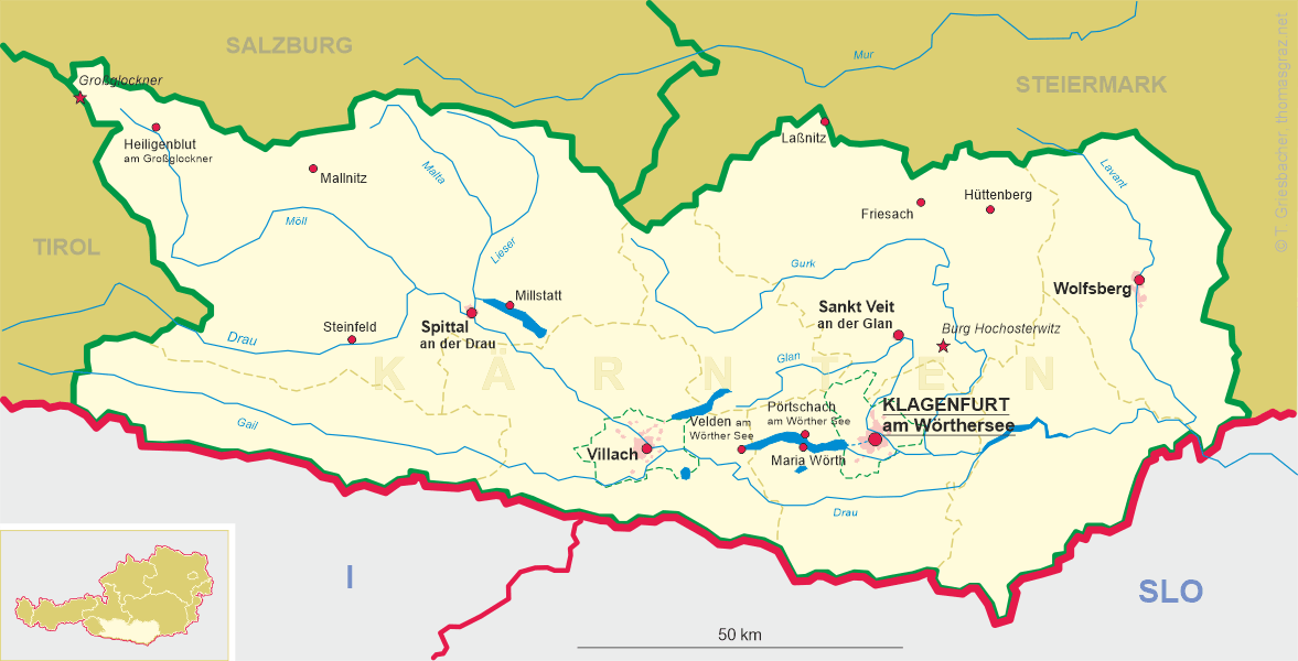
 Mallnitz is situated at an elevation of 1,191 m at the foot of the
Hohe Tauern massiv. It is a resort both for summer and winter tourism.
The administration of the National Park Hohe Tauern is located at Mallnitz.
The park was created 1971–1991 and is the largest alpine national park
(1,786 km², 304 mountains over 3,000 m, 246 glaciers).
For centuries only foot paths over the Mallnitzer Tauern pass (2,448 m)
connected the valley of the Mallnitzbach to the Gastein valley in Salzburg.
Between 1901 and 1909 the railway connecting Mallnitz via a tunnel (8.5 km)
to Böckstein near Bad Gastein in Salzburg was constructed. Since World War I not only passengers
but also cars are transported by this railway line which makes it one of the
important traffic connections between the two provinces.
Mallnitz is situated at an elevation of 1,191 m at the foot of the
Hohe Tauern massiv. It is a resort both for summer and winter tourism.
The administration of the National Park Hohe Tauern is located at Mallnitz.
The park was created 1971–1991 and is the largest alpine national park
(1,786 km², 304 mountains over 3,000 m, 246 glaciers).
For centuries only foot paths over the Mallnitzer Tauern pass (2,448 m)
connected the valley of the Mallnitzbach to the Gastein valley in Salzburg.
Between 1901 and 1909 the railway connecting Mallnitz via a tunnel (8.5 km)
to Böckstein near Bad Gastein in Salzburg was constructed. Since World War I not only passengers
but also cars are transported by this railway line which makes it one of the
important traffic connections between the two provinces.
The mountain depicted in the background of the picture on glass no. 4694 is identified by the labelling as
Gaislspitze, actually in modern orthography
 Geislspitze
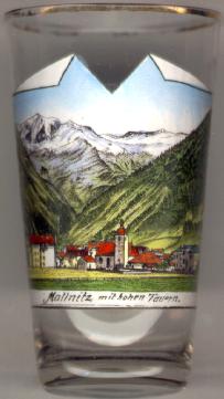
The parish church of Sankt Aloisius [near left, no. 476: centre] was first consecrated in 1758.
A new, modern, church was constructed in its place
in 1974/1975.
[https://www.bergfex.at/sommer/salzburg/touren/wanderung/1720139,hohe-geissel-vorderer-geisselkopf-2974-m/;
https://de.wikipedia.org/wiki/Pfarrkirche_Mallnitz]
![[scale]](lineal.jpg)