
|
|
| DEUTSCHLAND | GERMANY |
| Bundesland: Rheinland-Pfalz | Rhineland-Palatinate |
| Stadt: Koblenz |
map →
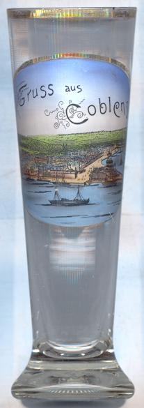 Koblenz is situated at an elevation of 129 m at the confluence of the rivers Mosel and Rhine.
Archeological finds show that the area was already inhabited during the Late Stone Ages. The Romans founded a castle around 10 BC which later became known as Confluentes. The Romans were driven out of the country by the Franks in the 5th century. In 1018, Emperor Heinrich II donated the town to the Archdiocese of Trier which remained in possession of Koblenz for 776 years. During the Thirty Years' War (1618–1648), French and Swedish troops occupied the city in 1632, which was followed by heavy bombardments of Imperial troops in 1636. French troops besieged the town again in 1688. French revolutionary troops entered Koblenz in 1794. After the Peace of Lunéville, Koblenz became part of France and was the seat of the préfecture of the départment Rhin-et-Moselle. After the Congress of Vienna in 1815, Koblenz became part of Prussia and became the capital of the Prussian Rhine Province. In 1926, the official spelling of the name was changed from Coblenz to Koblenz. Heavily damaged during World war II, Koblenz became the capital of the state of Rheinland-Pfalz (Rhineland-Palatinate) in 1947 and retained this function until 1950 (since then, the capital is Mainz).
Clemens Wenzel Lothar Fürst von METTERNICH (1773–1859), son of a noble Rhenish family, was born in Koblenz. Metternich served as
Austrian diplomat and statesmen and received the title Fürst (prince) in 1813. He decisively determined the Congress of Vienna (1814/15), which determined the fate
of post-Napoleonic Europe. Until 1848, he was perhaps the best-known leader of conservative politics in Europe. The revolutions of 1848, which were
in part directed against his repressive government system, forced him to take refuge in England. He returned to Austria in 1851.
The triangular piece of land between the rivers Rhine and Mosel has been called Deutsches Eck (German Corner) for centuries.
The name goes back to the knights of the Teutonic Order who had founded a seat of their order near this place in 1216.
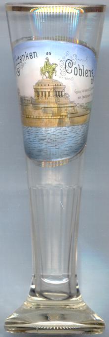
The  monument for Emperor Wilhelm I
Several glasses of this collection show other monuments for Wilhelm I.
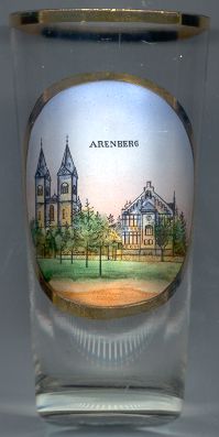
The parish church Sankt Nikolaus [left]
was built in 1860–1862 after plans by Hermann Nebel. The church was altered during a renovation in 1959/60.
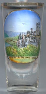
Schloss Stolzenfels [left], situated above the left bank of the river Rhine opposite of the
mouth of the river Lahn, was built in the 13th century as a stronghold of the Archbishops of Trier. Enlarged between 1388 and 1418 it later also served
as a residence for the archbishops. After occupations by Swedish troops in 1623 and by the French in 1634/36 and 1646/48, French troops destroyed the castle
during the Palatinate War of Succession in 1689. In 1815, the city of Koblenz donated the ruins to Crown Prince Friedrich Wilhelm (later King Friedrich Wilhelm IV) of Prussia,
who accepted the present in 1823. The architects Karl Friedrich Schinkel and Friedrich August Schüler rebuilt the castle as a royal residence in Gothic Revival style between 1836 and 1842.
![[scale]](lineal.jpg)