
|
|
| ÖSTERREICH | AUSTRIA |
| Bundesland: Niederösterreich | Lower Austria |
| Bezirk: Bruck an der Leitha |
map →

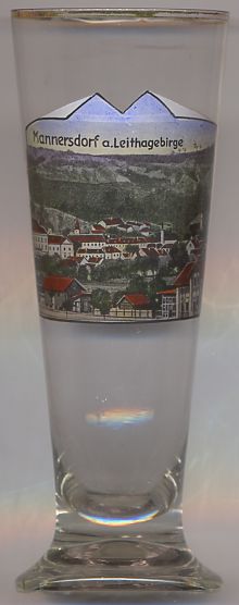
 Mannersdorf am Leithagebirge is situated at an elevation of 212 m at the northwestern slope of the Leithagebirge moutanins.
The first mentioning in a document dates from 1233. During its past, Mannersdorf was destroyed several times by invading troops, e.g.
by the Turks in 1529 and 1683, and by Hungarian rebels (Kuruzzen) in 1704, 1705 and 1708.
An extensive grave field of the early La Tène period (late Iron Age, between about 450 BC and 1 AD) was discovered in the 1930s.
All archaeological finds that were exhibited in the local museum were, however, destroyed during World War II. The museum was reopened with
new finds in 1979. Mannersdorf obtained the status of a town in 1989.
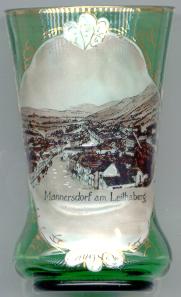
Mannersdorf am Leithagebirge is situated at an elevation of 212 m at the northwestern slope of the Leithagebirge moutanins.
The first mentioning in a document dates from 1233. During its past, Mannersdorf was destroyed several times by invading troops, e.g.
by the Turks in 1529 and 1683, and by Hungarian rebels (Kuruzzen) in 1704, 1705 and 1708.
An extensive grave field of the early La Tène period (late Iron Age, between about 450 BC and 1 AD) was discovered in the 1930s.
All archaeological finds that were exhibited in the local museum were, however, destroyed during World War II. The museum was reopened with
new finds in 1979. Mannersdorf obtained the status of a town in 1989.
![[scale]](lineal.jpg)