
|
|
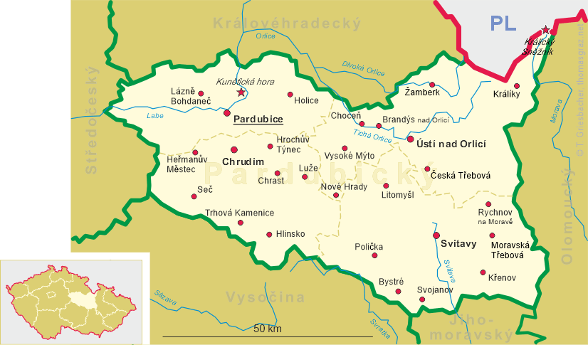
| ČESKÁ REPUBLIKA | CZECH REPUBLIC |
| Pardubický kraj | Pardubice region |
| Okres: Chrudim |
map →
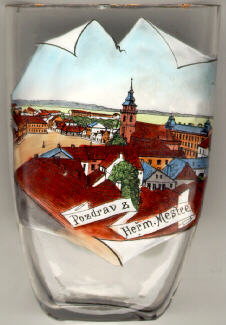 Heřmanův Městec is situated at an elevation of 275 m at the northern slopes of the
Železné hory (Iron Mountains) in the west of the district Chrudim.
The town was founded prior to 1280. The first mention in a written document dates from 1325.
A Jewish community was founded here in the 15th century. The synagogue was built in 1870.
The old town has been put under monumental protection already in 1898.
Heřmanův Městec is situated at an elevation of 275 m at the northern slopes of the
Železné hory (Iron Mountains) in the west of the district Chrudim.
The town was founded prior to 1280. The first mention in a written document dates from 1325.
A Jewish community was founded here in the 15th century. The synagogue was built in 1870.
The old town has been put under monumental protection already in 1898.
The  parish and deanery church St. Bartholomew (kostel svatého Bartoloměje) [centre] of 1756–1762 is one of
the town's most important monuments in Baroque style. The plans were drawn by the architects Kilian Ignaz Dientzenhofer and his successor Anselmo Lurago.
parish and deanery church St. Bartholomew (kostel svatého Bartoloměje) [centre] of 1756–1762 is one of
the town's most important monuments in Baroque style. The plans were drawn by the architects Kilian Ignaz Dientzenhofer and his successor Anselmo Lurago.
The former German name of Heřmanův Městec, Hermannstädtel,
is similar to the German name of Sibiu (RO), Hermannstadt.
![[scale]](lineal.jpg)