
|
|
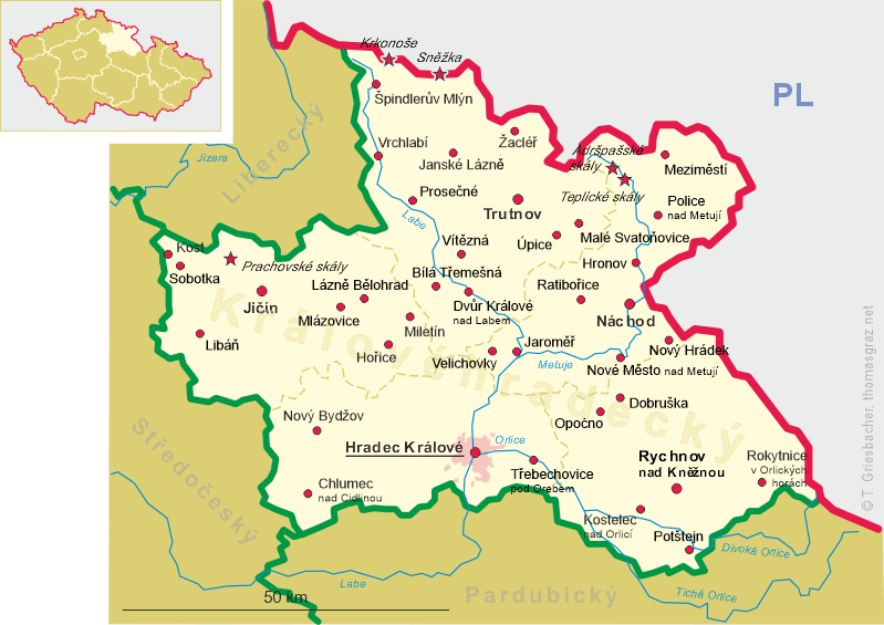
| ČESKÁ REPUBLIKA | CZECH REPUBLIC |
| Královéhradecký kraj | Hradec Králové region |
| Okres: Trutnov |
map →
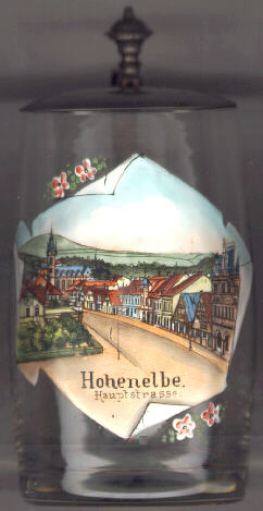 Vrchlabí is situated in the upper valley of the river Labe (Elbe)
in the mountain range Krkonoše (Giant Mountains, Riesengebirge).
The village was founded in the 13th century. The town obtained the
status of a Royal mining town in 1533. Mining for silver was stopped in the
18th century, mining of iron ended in the 19th century. Today car and textile
industry have economic significance for the town. The administration of the
Krkonoše National Park has its seat in Vrchlabí.
Vrchlabí is situated in the upper valley of the river Labe (Elbe)
in the mountain range Krkonoše (Giant Mountains, Riesengebirge).
The village was founded in the 13th century. The town obtained the
status of a Royal mining town in 1533. Mining for silver was stopped in the
18th century, mining of iron ended in the 19th century. Today car and textile
industry have economic significance for the town. The administration of the
Krkonoše National Park has its seat in Vrchlabí.
The  deanery church Svaty Vavřinec (St. Laurence) [background left]
was built in 1888 in Neo-Gothic style in place of an older church of the 14th century.
deanery church Svaty Vavřinec (St. Laurence) [background left]
was built in 1888 in Neo-Gothic style in place of an older church of the 14th century.
Another well-known sight of Vrchlabí are the typical
timbered houses with arcades [right]
which originated in the 17th/18th century along the main street.
![[scale]](lineal.jpg)