
|
|
| DEUTSCHLAND | GERMANY |
| Bundesland: Sachsen-Anhalt | Saxony-Anhalt |
| Landkreis: Harz |
map →
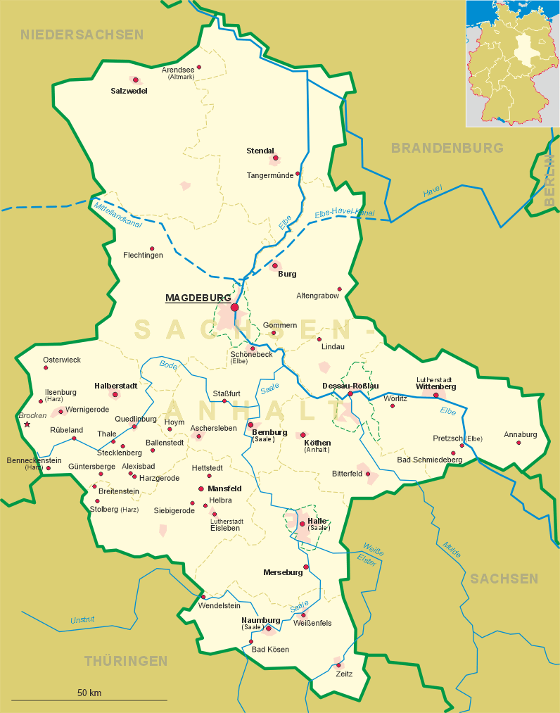
 Benneckenstein is situated at an elevation of 535–600 m at the edge of an elevated plain between the Oberharz and Unterharz mountain region.
It is the highest town of Sachsen-Anhalt.
Benneckenstein is situated at an elevation of 535–600 m at the edge of an elevated plain between the Oberharz and Unterharz mountain region.
It is the highest town of Sachsen-Anhalt.
Benneckenstein was first mentioned in 1319. Since the Middle Ages iron and wood working were the main basis of income. The development was, however, hindered by the fact that at times it was divided between up to three owners. In the second half of the 17th century one half of Benneckenstein belonged to the Electors of Brandenburg (Dukes, 1701 Kings in Prussia), the other half had been inherited by the Counts (1697 Princes) of Schwarzburg-Sondershausen. The latter half was purchased by Prussia in 1741 and the now united community received the status of a town. Since 1887 Benneckenstein is a tourist resort. The Harz narrow gauge railway (Harzer Schmalspurbahn) from Nordhausen to Wernigerode was opened in 1889.
The  church St. Laurentius [top picture, centre left] was built in 1853.
It is one of the few churches which is not oriented towards the east but towards the west.
church St. Laurentius [top picture, centre left] was built in 1853.
It is one of the few churches which is not oriented towards the east but towards the west.
The bottom left inset shows the country inn
Waldschlösschen
The bottom right inset shows the
Kriegerdenkmal
The inventor of the "Musical Temperature" (tempered tuning), Andreas WERCKMEISTER (1645–1706),
was born in Benneckenstein. The house where he spent his youth is the oldest preserved building in Benneckenstein.
![[scale]](lineal.jpg)