
|
|
| DEUTSCHLAND | GERMANY |
| Bundesland: Brandenburg | |
| Landkreis: Oberspreewald-Lausitz |
map →
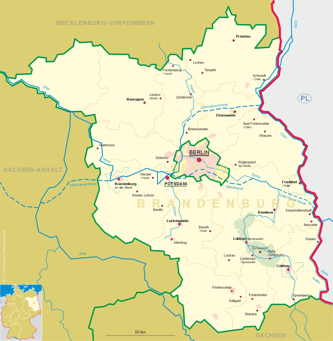
 Freienhufen is situated at an elevation of 122 m about 4 km west of Großräschen in southern Brandenburg.
The name Freienhufen was only introduced in 1937; before that, it's name was Dobristroh.
Freienhufen is part of the municipalitiy of Großräschen and has a population of about 700.
Freienhufen is situated at an elevation of 122 m about 4 km west of Großräschen in southern Brandenburg.
The name Freienhufen was only introduced in 1937; before that, it's name was Dobristroh.
Freienhufen is part of the municipalitiy of Großräschen and has a population of about 700.
Dobristroh was first mentioned in a document of 1279. It was located on the "Salt Road", which was
used as a trading route between east and west. Until 1602 it belonged to the domains of the
monastery Doberlug. After paying a sum of 5,500 guilders to the monastery it became a free community
but had to pay a confirmation fee to the Prussian kings each time the country got a new sovereign.
This obligation was finally abolished when the Niederlausitz (Lower Lusatia) region became part of Prussia in 1818.
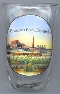
The foundation of the briquett plants "Renate" and "Eva" (see the picture on glass no. 1919, left) in 1896 and 1900,
which had been named for the two daughters of the owner of the coal mining company,
brought new opportunities for Dobristroh. Many new workers moved here which caused a significant increase in the population.
In 1937 Dobristroh was renamed Freienhufen. A new, modern, briquett factory, named "Sonne",
was built in 1952–1954 and operated until 1997. In the same year the inhabitants of Freienhufen
voted for a unification of their community with Großräschen.
![[scale]](lineal.jpg)