
|
|
| DEUTSCHLAND | GERMANY |
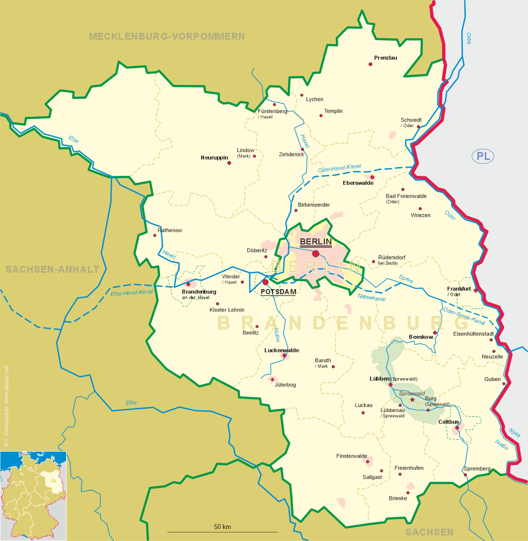
| Bundesland: Brandenburg | |
| Landkreis: Uckermark |
map →
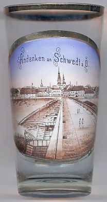 Schwedt is situated at an elevation of 6 m in the Uckermark district, between the rivers Oder and Havel.
The Hohensaaten-Friedrichsthaler Wasserstraße (canal) runs between the town and the Oder river.
With its population of about 37,000 Schwedt is the district's largest community.
Schwedt is situated at an elevation of 6 m in the Uckermark district, between the rivers Oder and Havel.
The Hohensaaten-Friedrichsthaler Wasserstraße (canal) runs between the town and the Oder river.
With its population of about 37,000 Schwedt is the district's largest community.
The oldest traces of human settlements in this area date from the Bronze Age, about 1000 BC.
in the 6th/7th century Slavic tribes settled here. Around 1230 the castle and the settlement came in possession of the
margraves of Brandenburg. The earliest written mention of Schwedt dates from 1265.
From 1223 until 1234, and again from 1354 until 1468 Schwedt was in possession of the Pomeranian Dukes.
The margraves of Brandenburg finally obtained the town in 1468.
The 16th century was a first flourishing period for Schwedt. The privileges as a town were confirmed in 1513 and 1587.
As the town was located at the crossroads of important trading routes from Stettin (Szczecin) and
Prenzlau to Berlin and
In April 1945, shortly before the end of World War II, Schwedt was almost completely destroyed. As the river Oder became the new border between Germany and Poland, Schwedt suddenly became a border town.
The  church Sankt Katharinen [background]
was built in the 13th century. After a fire, the church was rebuilt and enlarged in 1887.
In 1945 the church was heavily damaged. The church burned out, although most parts of the vaulting survived.
Only the lower parts of the tower (height 30–35 m) survived, whereas the upper, wooden structure which had had
a height of further 30 metres was destroyed and was not reconstructed after the war.
church Sankt Katharinen [background]
was built in the 13th century. After a fire, the church was rebuilt and enlarged in 1887.
In 1945 the church was heavily damaged. The church burned out, although most parts of the vaulting survived.
Only the lower parts of the tower (height 30–35 m) survived, whereas the upper, wooden structure which had had
a height of further 30 metres was destroyed and was not reconstructed after the war.
![[scale]](lineal.jpg)